Nine Peak Challenge, San Gorgonio 5/24/13 - 5/27/13
Josh and I undertook the 9 peak challenge in San Gorgonio this Memorial Day weekend. I was late securing my permit and the only space that was left was Trail Fork Springs Camp via Forsee Creek Trail. This meant there would be a lot of back and forth on our hike, but we would do so with a light pack, as we would not have to move camp.
Josh and I undertook the 9 peak challenge in San Gorgonio this Memorial Day weekend. I was late securing my permit and the only space that was left was Trail Fork Springs Camp via Forsee Creek Trail. This meant there would be a lot of back and forth on our hike, but we would do so with a light pack, as we would not have to move camp.
We headed out on Friday after work and spent the night at the trail head in my truck in order to get an early start Saturday morning.


After a relatively comfortable nights sleep, we woke up at about 6 am and commenced coffee and prep for our long weekend. At this point, we realized that we had but one spoon to share for our meals. This was going to be fun. Note to self...keep extra stuff in the truck.


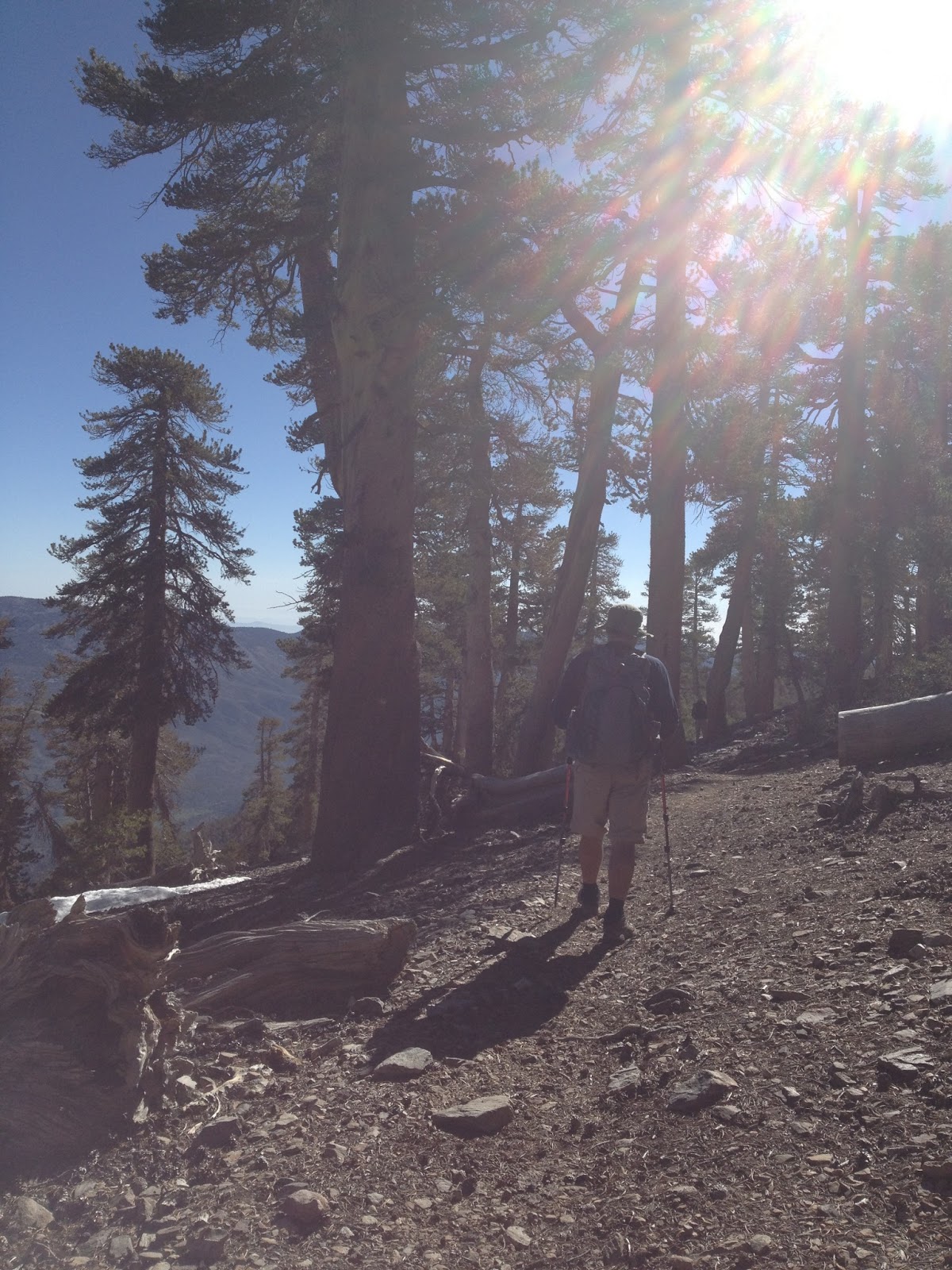
It was about 7 am when we finally hit the trail. There were two groups heading up that morning, one was a boy scout troop out of Oceanside. They were going to Jackstraw Camp a few miles below our destination. We leap frogged them a few times on the trail.


Heading up to camp was a work out. It is a steep trail going from 6,800 feet to 10,440 feet in just under 7 miles. Beautiful views and perfect weather. We ran into a couple of Rangers going up, and they checked our permit. We leap frogged them a couple times too, which was beneficial as one of them told us where the best camp site was at Trail Fork.


Luckily, we ran into the rangers again just as we passed our camp. The signs on the Forsee Creek Trail are really high up the trees and easy to miss. The ranger told us to look for a patch of snow at the top of the flats for the camp site he was talking about. We thanked him and headed up the steep slope.


Yes, I'm posting to Facebook. Don't judge me. :-)


We found the spot he was talking about and realized he was not exaggerating. It really was the best spot in the house. The views of Big Bear Lake and beyond were stunning.


Josh decided to get his ya ya's out on the mountain side, rocking his new Dirty Girl Gaiters.


We ate, napped and watched the wildlife for a couple hours before getting water and planning our first peak adventure.
Josh proves that necessity is the mother of invention and made a spoon out of the lid to the fuel canister, a stick and some duct tape.
Nice!


Finally we headed out for a recon mission and to bag Sheild's Peak. We hiked up to the San Bernardino Divide trail which walks the backbone of the San Gorgonio Wilderness.


Shield's Peak is a huge mass of scree that is not easy to traverse. We took off from the trail up the side of the mountain and hit two false peaks before finding the register box at 10,680 feet.


Peak number one in the bag. Piece of cake right? Not so much...we looked down the ridge at what we had to do tomorrow. Yikes.


We headed back to camp ate dinner, laughed, joked and watched one of the best sunsets I've ever seen.


We woke up at 6am and commenced the morning prep. Today is going to be a huge mileage day.
We were the first ones in camp yesterday and the first ones out of camp today.


On the agenda: Alto Diablo, Charlton, Little Charlton, Jepson and the big daddy; San Gorgonio at 11,503 at a little under 16 miles round trip. Once on top of the ridge line we did some stretching and last minute adjustments and headed for Alto Diablo.


After a few switchbacks we reach the base of Alto Diablo and scramble the short distance to the top.
Alto Diablo is at 10,563 feet. That was almost too easy...on to the next.


Elevation makes people weird. This is the first entry in the register.

Continuing along the ridge line we head for the Charlton's. On the way we pass through Sheild's Flat camp, and High Meadow Springs Camp which are both very beautiful. Josh spotted a malady in one tree's bark that looked like a barn owl. Pretty cool!


We came to Red Rock Flat camp which is just before Dollar Lake Saddle. This would prove to be the thorn in our side, as you lose a bunch of elevation and then have to gain it all back. The views of Dollar and Dry Lake were beautiful. I was surprised to see them both dry this early in the season.


We start the ascent out of the saddle at the base of Charlton Peak. We opted to pass up the Charlton's to bag Jepson and San G, while we were still fresh. We also were hoping to gain a better vantage point of Big and Little Charlton, to ensure we weren't heading up the wrong mountain. Since none of the peaks are identified on the trail we wanted to be sure our map skills were up to par.
We took a break at the base of the Charlton's and readied to break the tree line at the 11,000 foot mark.


I've always wanted to walk on the moon. San G is probably the closest I've come to it, so far.


Once we rounded the corner toward San G we tried to identify Jepson Peak at 11,205. We choose a chute to traverse and headed for the high point we believed was Jepson. The sand up here is super soft, akin to walking in beach sand. Josh has found that if you step on the rocks you avoid sinking in and save your calf muscles.


When we got to the register box we were surprised to only see a couple of cards inside. No book, no pen. I used a match to write a note that we were there and had a look around.


It was then that I saw a higher peak in the distance. That must be Jepson. I was not impressed.
False peaks SUCK.

on the plus side, there was some big horn sheep scat to look at. I love finding scat and bones.

We bit the bullet and headed up the REAL Jepson and were pleased to find the register confirmed our summit was correct.


Two peaks down plus one stupid false peak...grrr...lets get the big daddy, San Gorgonio


On the way up Josh had the good idea to get some snow in our gravity filter's dirty bag. This way he could ice his sore knees on the summit and have some water reserve, as our next water was back at High Meadow Springs Camp.


After the final push up the rocky slope, we arrive on the summit.
AH HA!
San G is always amazing. This is Josh's second summit and my fourth. San G is the tallest mountain in Southern California.
It was busy at the top so we found a quiet spot to rest and snack.


Summit Yoga is always good.
Prepping for the long road back. We aren't done for the day, there are still two more to bag.


At 2pm we took off down the mountain for the Charlton's. Once back at Dry Lake View Camp we assessed the situation and decided to blow straight up the side of Little Charlton at 10,700 feet.

We found the summit register after a few false peaks and then looked up to our next challenge.


Charlton was across the saddle and looked like he was going to be a major pain in the ass. Luckily we found some rock cairns marking a use trail, which guided us up the steep slope.


We made it to the top!...oh, no we didn't...false summit.
Keep climbing!!

Finally the register box. I am pretty worked by now and glad we are done peak bagging for the day. Lets sign this thing and go back to camp and EAT ALL THE FOODS!!


The thought that we are done now and can relax was quickly dashed when we lost the use trail and headed straight down this. So far I've not lost my toenails, but not for lack of trying.

We made it back to the ridge trail and headed toward camp, sore, tired, hungry and accomplished. I kept thinking "we may ACTUALLY do it!"


We made it to the section of trail just below Sheild's Peak. I was pretty worn out and stepped on a loose rock which catapulted me, head first, down the scree field. I managed to right myself only to see Josh flying down the mountain after me. He stopped me from tumbling the 5000 feet or so down to hwy 38 and my death. Thanks Josh! After a short bodily injury inventory I decided nothing was broken and that I didn't need to cry or barf from the shock. I was lucky to come away with only a sprained pinky and some scratches.


Back at camp we ate dinner and bundled up for bed early. We were both pretty worked and I had the chills that would not stop! Tomorrow is the last three peaks and our mission will be accomplished!


We woke up after a long night of tossing and turning due to sore muscles and stuffed noses. We opted for coffee and dark chocolate covered espresso beans in the tent.

We packed up after oatmeal and granola breakfast and headed out for our final day of peak bagging.


Back up at the ridge line trail we looked up at Anderson Peak at 10,840. He was a beast. We dropped pack and I emptied my gear taking only water and the ten essentials up with us to the summit. We again happened upon a false peak and the climb went on a little longer than expected.


We got to the register box at about 9am and were happy knowing this was the last of the difficult peaks.


We did a little more Yoga on the top of Anderson and headed back down to collect our gear and make our way to East San Bernardino Peak.


East San Bernardino Peak at 10,691 is surprisingly easy, as it is right off the trail. We ran up to the top and looked at where we'd come from. I am impressed with us!


Only one left to go! We started back out on the ridge trail and made our way to San Bernardino Peak at 10,649. There was another drop in elevation before gaining it back. San Bernardino Peak is also right off the trail and was not to difficult to summit.

We made it to the top, peaked over the edge and VIOLA! We did it! The final summit register box!


HOORAY!!


The last peak in the bag we realized we had a LONG seven mile trip back to the truck. We found a shady spot and made some lunch. We discovered that we need to pack more food for our big trips. We improvised with what we had left and made instant mashed potatoes mixed in with our Chex Mix crumbs. It was surprisingly really tasty!


Josh was romanced by a butterfly for a few minutes.

Lets not stand on ceremony, let the journey begin!


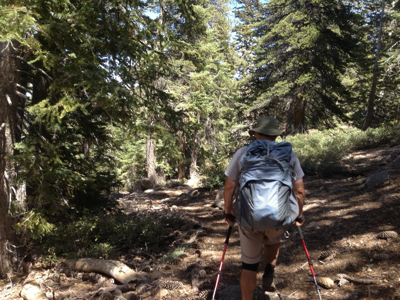
We headed out toward Angeles Oaks and Limber Pine Camp.
We visited Washington's Monument, which was Southern California's initial point used for surveying during the development of the Inland Empire. To my understanding, this is the center of Southern California as indicated on our maps, at least, it was in 1852.
Henry Washington, who was a surveyor, built a tower here that was visible from the valley below where a meridian line could be drawn.
The tower isn't really much to look at any more, just a pile of rocks but has a great view of San Bernardino and Mill Creek.


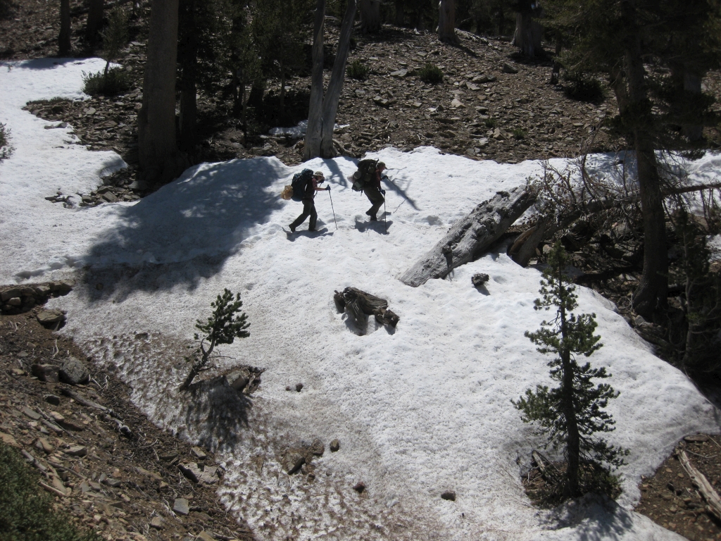
We followed the trail down to Limber Pine Camp and filled up our water. We met a couple of folks heading up and did a few snow traverses.


Our next turn off would be an unmaintained section of trail that heads toward John's Meadow.
They aren't kidding when they say it is unmaintained. It was steep, loose and really difficult hiking.


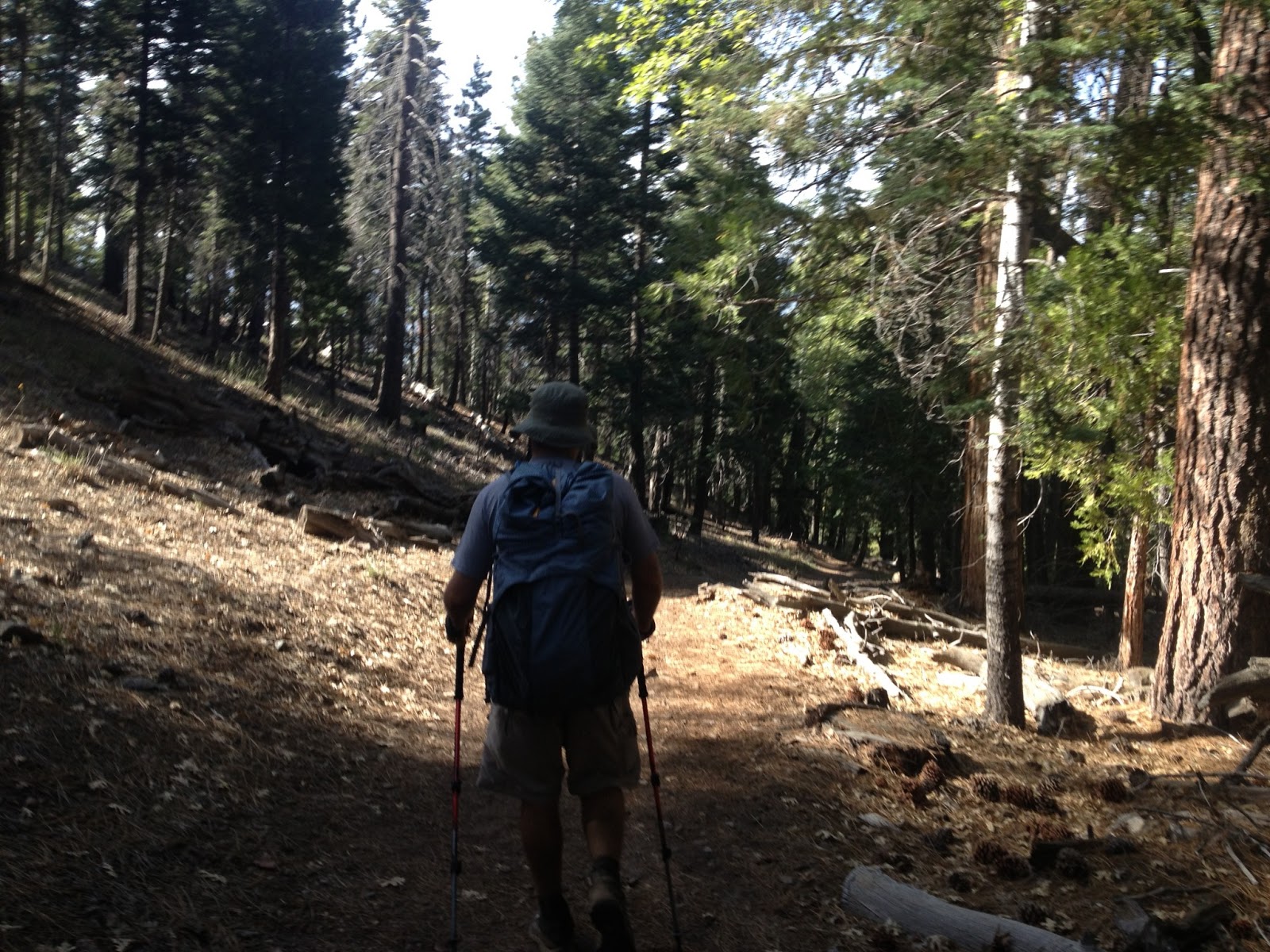
Finally we crossed Forsee Creek and made it to John's Meadow and back on the real trail. Josh and I are pretty much over it by now and our dogs are barkin'! We still had four miles to go...


When we reached the junction sign at Forsee Creek Trail and John's Meadow Trail I let out a holler that startled Josh. I was so excited to have less than a half mile to go to get to the truck! We may survive this thing after all!


We hobbled down the last part of the trail and my truck came into view. Oh, to sit down and take of my shoes! I was stoked. The amount of dirt on your legs and feet is a sign of a good time. This trip was epic!


Amazing how much dirt gets on your legs even with long pants on!

We cleaned up and headed down to Redlands where we ate Shakey's Pizza and Dairy Queen. We raided Dairy Queen for their long handled spoons so we would never be single spooned again!

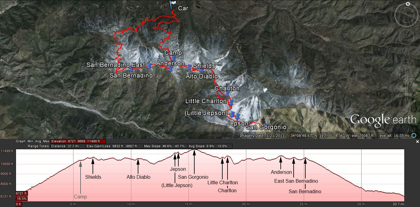
This is the profile of our trip. Not bad for a three day weekend.
After we got home I iced my knees, Josh took care of some blisters and we started prepping for our high Sierra loop next weekend. It seems we are the epitome of gnar hikers. I wouldn't have it any other way.


On to the next. See you at the TOP!
Great great report! What an accomplishment.. Can't wait to read about your Sequoia trip!
ReplyDelete