Oh, how I love the Eastern Sierra.
Finally, the Government pulled their heads out of their butts and allowed the National Parks to reopen. Josh and I jumped at the news and traded in a permit for Aspen Grove in San Gorgonio for a trip to The Devil's Postpile and Yosemite National Park.

Every trip Josh and I take seems to turn into a Pacific Crest Trail recon mission at some point. On our way through Independence we took a detour to Onion Valley to scout out Kearsarge Pass where we will exit the Sierra to resupply.


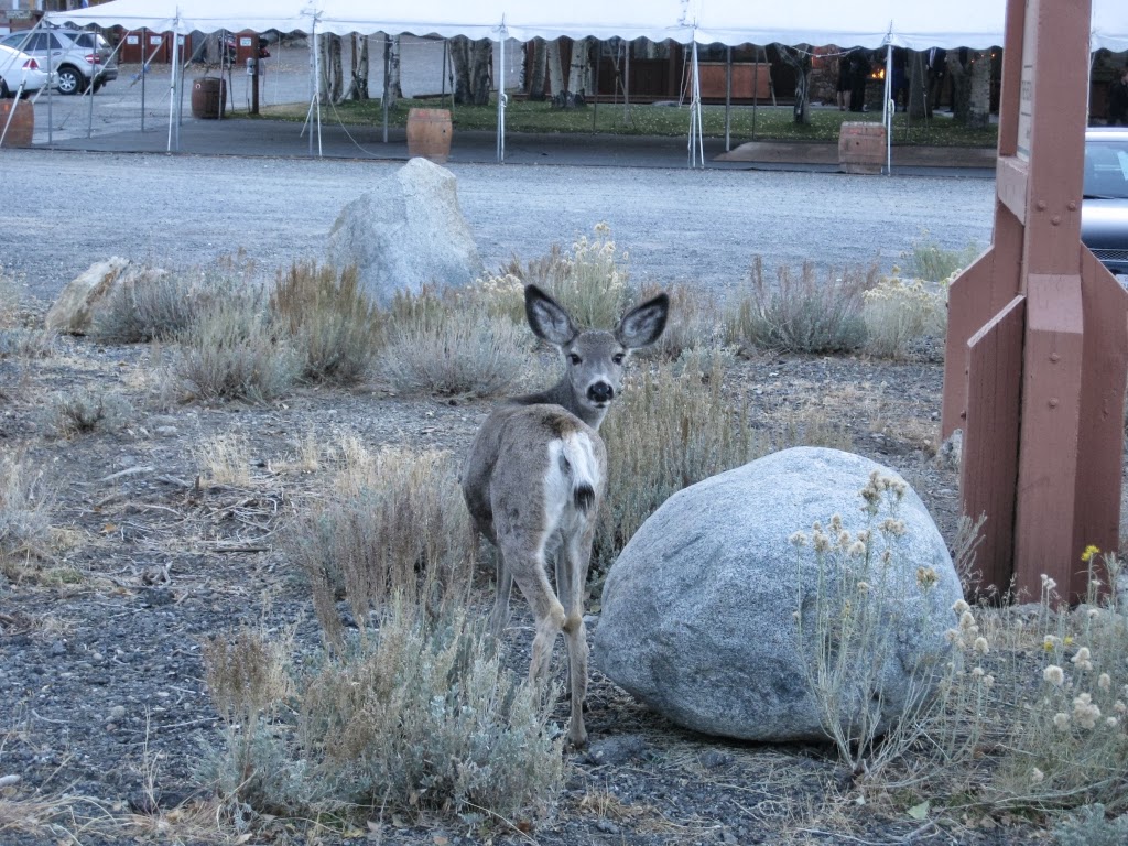
Not only did our trip coincide with an epic full moon, but a full on Mule Deer migration as well.


At the end of the long road through Onion Valley we parked and checked out the area with our binoculars.


The mountains were amazing, to say the least. We debated whether or not to stay here and hike to the top of the pass or continue on to Mammoth.


We decided to head for Mammoth and drove back down the mountain to rejoin Hwy 395. There were Deer EVERYWHERE!


At last, the Minarets came into view as we turned onto Hwy 203 and drove through Mammoth Village.


We drove to the entrance for The Devil's Postpile and hung a right on the road to Minaret View parking area. When we arrived, we were greeted by a group of photographers taking in the full moon.


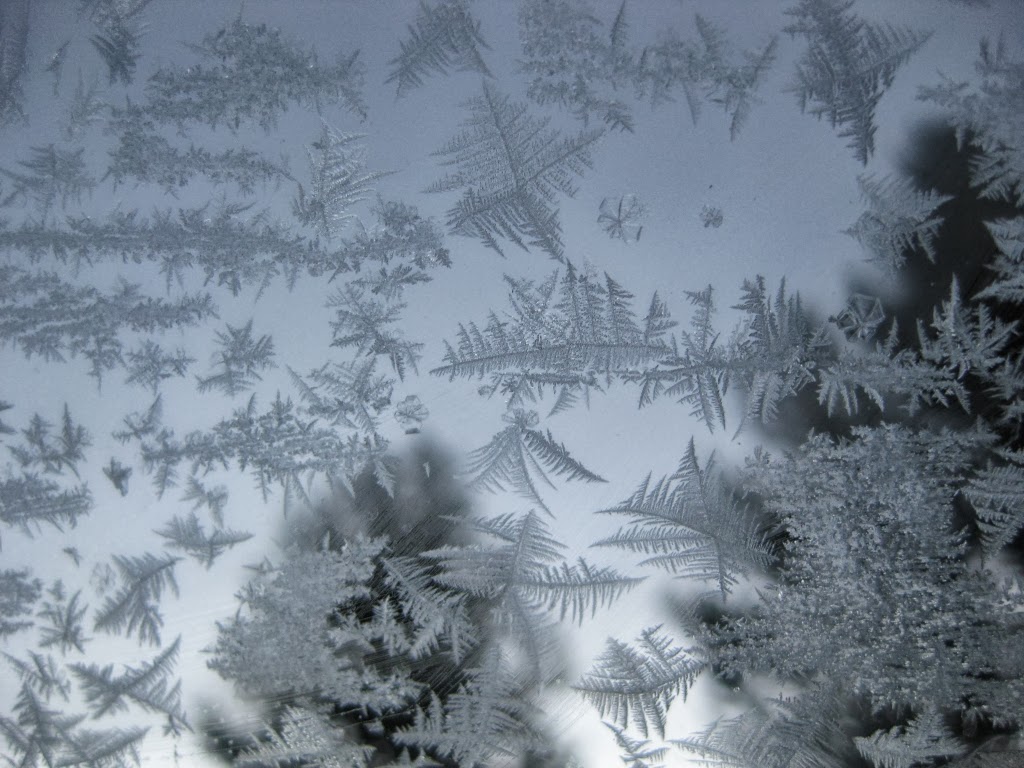
It was SUPER cold and my phone managed to take only blurry pictures of the moon.

We decided to find a place to park for the night and sleep in the back of the truck. We drove down to the Earthquake Fault Trailhead, ate dinner, played a couple games of UNO and hunkered down for the night. I don't know if you're allowed to overnight park here but there were no signs and no one gave us any trouble for doing so.


After a comfy night in the back of the truck, we woke up around 6am. Anxious to get on the trail and avoid having to take a shuttle, we opted to get into the park and have breakfast there.


It was cold.
Not the cute "oh, I can see my breath" cold. More like "HOLY CRAP, MY FACE IS GOING TO FALL OFF" cold.
Not the cute "oh, I can see my breath" cold. More like "HOLY CRAP, MY FACE IS GOING TO FALL OFF" cold.


Josh, being the chivalrous guy he is, got us water from the creek. I'm surprised he didn't lose a hand to the cold. After coffee and breakfast we headed out for the Postpile and beyond.


We hardly had time to warm up when we arrived at the geological feature. It was impressive, albeit much smaller in length than I expected.


The Postpile formation is made of columnar basalt rock which is formed when lava cools rapidly. There are formations like this all over the world. This particular formation was much larger originally but has eroded over time due to the glacial influences that shaped the Sierra.

We continued past the Postpile toward Rainbow Falls. I'm not sure if it was the cold that kept shutting my phone off, or if there were magnetic forces at work from the rock formation, but it was a bummer to not be able to use my camera. Note to self, get reliable camera for PCT!


The Devil's Postpile Monument and Rainbow falls are contained within the Ansel Adams Wilderness and at a junction of for the John Muir and the Pacific Crest Trails. We are itching so bad to get on the PCT we are drawn to it every weekend!


The creek was frozen over in some areas but you could still see fish swimming below the quarter inch of ice.


All around the leaves had changed on the Aspens and Black Oaks. I could feel a sense of urgency in the air as the chipmunks rushed around with acorns in their mouths, too busy to care about our presence. Winter is coming!


After about 2 miles we came to the edge of Rainbow Falls, at 101 feet tall it was impressive!


Climbing down the steep stair case we marveled at the rock formations and plants hanging on the side of the rocks.


At the bottom we took lots of photos, ate and goofed around before hiking back up the giant stair case.


We made this a loop hike and took the trail junction to walk on the top of the Devil's Postpile to see the hexagonal formations that extend into the interior rocks.


On our way out we passed the huge crowds heading toward the monument and were glad we were on our way out. At the rangers kiosk we paid our $10 entrance fee and headed on toward Yosemite.
Well, not before stopping at Schatt's Bakery for coffee and pastries. YUM!
Well, not before stopping at Schatt's Bakery for coffee and pastries. YUM!


No trip up HWY 395 is complete without visiting the Whoa Nelly Deli at the Tioga Pass Mobil Station. I don't care what diet you're on. Just do it! We ate and I bought presents for the family before heading on through the pass.

Yosemite is amazing. It doesn't matter what season you go in. My brain cannot compute the beauty here, leaving me just saying "wow" over and over even now, looking at the photos.


We drove down into the Valley and hoped that it would be less crowded so we could spend some time exploring. We parked at the visitor's center, secured our food and headed out. It was still crowded, and super commercial feeling. We decided to abandon Yosemite Valley exploration for a more secluded venue. I've decided the next time I go to the Valley it will be hiking IN and promptly riding a bus OUT of it on the JMT next year.


We stopped on the side of the Merced river at about the same area where we swam during the summer. The photos we took really lend another reason why Muir called the Sierra 'The Range of Light'.


Driving back out toward HWY 395 via Tioga Pass we stopped at the Olmsted view point to watch the alpenglow in the Valley. The views of Half Dome and the surrounding peaks were amazing. This will be our path next year.


It was starting to get "HOLY CRAP" cold again so we continued on out of the park to find a place to sleep for the night.


There is no overnight camping within the National Park boundary so we exited the park and set up shop at the entrance to a campground that was closed for the season. We spent a chilly night in the back of the truck and woke to find our condensation had frozen to the INSIDE of my camper shell's windows. We were literally sleeping inside and ice box. I was warm all night in spite of it with my enLIGHTend equipment quilt, however getting dressed was done in layers as I warmed up my icy clothes.


Being from coastal and desert areas in Southern California, an icy windshield was very novel to me. I had to laugh at myself when I turned on the windshield wipers to clear the ice. Yeah, try again. I took out some grocery store member cards from my wallet and Josh and I went about the task of scraping the windshield.


Wanting to get an early start we drove to Tenaya Lake to do our morning ritual. We chatted with a couple of mountain climbers who were prepping to climb Tenaya Peak. It was once again "HOLY CRAP" cold and we begged for the sun to rise.


Bellies full we parked at the trailhead for Waterwheel falls and headed out toward the PCT. At last the sun had found us and we started to thaw out.


We followed the Tuolumne River to the trail junction for the PCT.


After a creek crossing the path meandered through the pines to a large granite boulder where we lost the trail. After some lost time bushwacking, Josh used his good map skills and put us back on the path.


We stopped at a small lake and filtered water from the creek. I perused the map and tried to take in the area.


These amazing granite faces boggled my mind. I spent a lot of time looking around and trying to imagine the size of the glaciers that formed them.


Still on the PCT we come to a section of trail that looks more like a cobble stone road. Thanks trial crews!

After a couple of miles we come to a bridge crossing over the Tuolumne River as it cascades slowly down the canyon.


After crossing the bridge, the falls became very active. The drop in elevation started to become more severe as the river valley merged with the canyon that holds Waterwheel falls.


We rock hopped down the river, marveling at the crystal clear pools and pristine beaches. Even in the cold weather, the water looked so inviting!


Finally, we reached the edge of the river valley and the 50 foot high Tuolumne Falls. Breathtaking!


We opted to cross the river and have lunch on the rocks that had a better view.


Mountain House eggs and bacon in a tortilla is awesome!


After a short rest we headed back. While we wanted to stay forever we knew we had a long drive back to San Diego.


Back at the truck we planned to stop at a grove of Quaking Aspens at the base of the Tioga Pass for photos.

So. much. beauty.


If it weren't for the call of the Whoa Nelly Deli, we may have stayed for the rest of the day.


Back on the 395 heading home, we detoured to Convict Lake to scope it out. Convict Lake was named after a group of escaped prisoners who were captured on it's banks. One of the posse members: Robert Morrison, was killed in the encounter and Mount Morrison was named after him.


After a short visit we bid the locals farewell and headed home.

Our hike to Rainbow Falls and the Devil's Postpile was about 5 miles.
.jpg)
Our hike to Tuolumne Falls was about 10 miles.

We had an awesome trip!
Next weekend Joshua Tree!!
No comments:
Post a Comment