Josh and I planned to do the Dry Lake/Dollar Lake loop in San Gorgonio as a two day backpacking trip. We left San Diego on Friday night and spent the night in Josh's truck at the trailhead. When we woke up, we were in an ice box. The thermometer read 20 degrees and we were only at 6680 feet. We popped out of the truck and tried to warm up by having some coffee and breakfast. As we hopped around trying to get warm it started to snow. While we are happy that Southern California is finally getting some precipitation, we knew that if it is this cold at 6680 feet it is going to be brutal at 9800 feet where we were to camp.
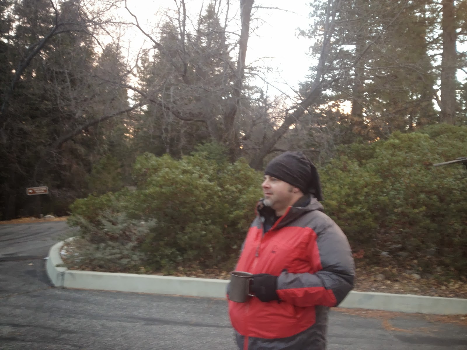
We decided to throw in the towel and head to lower elevation. To the desert!

We arrived at the Whitewater Preserve on the outskirts of the Coachella Valley around 9am. After Securing our permit from the ranger we started out toward the PCT.


I love the signage here. Everything is clean and well done. In just a couple month's this will be our itenerary and mileage chart!

After leaving the trailhead we junctioned with the PCT at mile 218.6 and headed north.


After following the river for about two miles we crossed and headed toward a canyon.

I couldn't have asked for a more incredible day!

While crossing the river we noticed several animal tracks. It was hard to tell if they were dog or coyote and there were some I am sure were cougar. Very interesting!

.JPG)
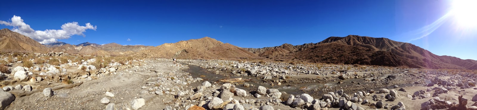
As we left the river valley we checked the water report to see if we need to pack in extra water. I told Josh I was confident that Mission Creek would have sufficient water and we left carrying only a couple liters.

The trail winds through the canyon to what looks like a dead end. The canyon walls rise steeply in all directions. We took a minute to try and locate where the trail would take us out but could not decide. We started out on a series of switchbacks taking us through several different types of rock.

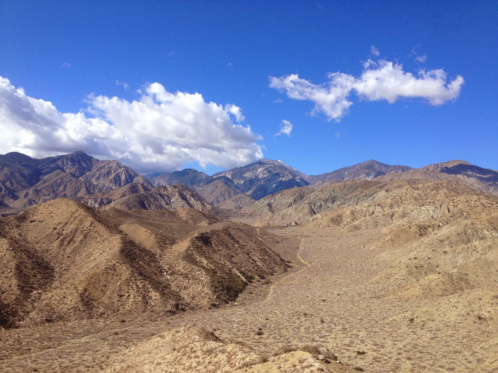
Finally at the top we took in the views of San Jacinto.

We descended a series of switchbacks into a new desert valley. The terrain was hot and exposed and we felt as if the hiking was more of a slog than anything.


We pushed on for a mile or so before deciding to grab a small piece of shade for a snack.

We broke out our food bags and set about trying the options we had chosen for our resupply boxes. As we ate trail mix and candy bars we realized we didn't have a taste for the sweet food like we thought we would. Good to know. In the desert we want to try to stick with salty snacks, probably due to the electrolytes we are shedding when we sweat.


After lunch we continued North. San Gorgonio started to come into view and I was struck by it's beauty. I have never seen 'my mountain' from this angle before and it is breathtaking!

There is a trail that junctions here and shoots off across the desert toward the base of San Gorgonio. This must be the trail to the headwall and various forks of the Whitewater river. I MUST return to hike this. I have always wanted to see the headwall and attempt to climb up to Big Tree Camp from this side.

We could see major weather taking place on the south face and thanked our lucky stars we decided to head to lower elevations. Staying on the mountain would have sucked for sure, if not been dangerous.

The trail turned into a new valley, heading away from San Gorgonio and switch backing up to a ridge. As we hiked we came across this rock with many uniformed sized holes in it. What are they? They look too small to be metates. Do you know what they are? Leave me a comment!


As the switch backs climb higher, the views become better and better, if that's even possible.


Now out of the canyon we start a long ridge walk with views of Desert Hot Springs and the rest of the Coachella Valley.


I spotted a tree with several large galls. I love galls they are so interesting and beautiful. I joked with Josh that in a couple month's we will be cursing the bugs that are growing here.


The trail meanders on the ridge unintuitively for a few miles. Back and forth, back and forth.

At last we spot Mission Creek and start our steep decent into the canyon. We both remark at how similar the trail is to the Bradford Ridge trail that takes you down to Deep Creek Hot Springs in Arrowhead. Every SoCal hike we do reminds us that we are going to have AN ENTIRE MONTH of this terrain. It all looks similar but you're going further north all the time.


We arrive at the waters edge at mile 223, give or take. Only about 8 miles from the start of our journey but somehow, we are feeling exhausted! Perhaps it is our lack of backpacking lately with all our injuries, illness' and prep for the thru hike. We are out of shape!!

Gutthook's app says we are at a tent site and we decide this is to be the site for the night.

What a beautiful area. I can't believe I grew up here and never knew this existed! I kick myself for spending so much time getting loaded when I could have been hiking my butt off! So it goes, I guess..So it goes.


.JPG)
Our campsite for the night!
.JPG)
.JPG)
After some more snacking we went to the creek to cool our dogs. The creek was SO COLD! We could only put our feet in for a second before the would start aching.
.JPG)
I don't know what is going on with my feet. It looked like I was starting to lose the nail on my second toe. I don't know if this is from my footwear or from a skin condition that I have. Only time will tell! Look at those swollen piggies!
.JPG)
EWWWW
.JPG)
This is our new tent's maiden voyage. It was a bit of a learning curve to set up, but so far it is awesome! So much more room over the Big Agnes and half as heavy.
.JPG)


As the sun started to set behind the mountain we decided it was time for dinner.

Josh thought to bring Oreo's. See? :-)

After dinner we retired to the warmth of the tent and our quilts. Josh is a cold sleeper! It was a long night with the sounds of animals all around the creek and the trail sounded like a freeway with animal traffic. It could have been in my head though, after we saw a coyote coming down the mountain just before bed.

The next morning it took us a while to get up and go due to the cold. Once we finally hit the trail we watched a storm coming over the horizon. These lumpy clouds are mamatmus clouds and usually indicate rain within the next 12 - 24 hours.


From the ridgeline we could see the Salton Sea shimmering in the distance.

The clouds cast an interesting light on everything. The desert pinks contrasted against the blue skies.


We happened upon a stink beetle that was missing a leg. We watched him stumble around for a while and took inspiration from him. If he could keep on trucking missing a leg, we could too with merely sore feet.

The way out seemed far easier and faster than the way in.


It is interesting to see the area from the other direction and we notice rock formations we had missed on the way in.


As we dropped back into Whitewater Canyon we breezed past day hikers and kept our eyes peeled for bighorn.

It was a beautiful hike and we have plans to return next weekend to hike out to the San Gorgonio headwall. The PCT class of 2014 is in for a treat when they hike this section! It is beautiful!

Thanks for posting this info about your PCT prep hikes. I get in the habit of hiking the same handful of trails year round, but so many of your posted hikes would make great new day or overnight hikes for us OC locals. I got hooked on the PCT blogs last year, and I'm looking forward to following the Class of 2014. Good luck.
ReplyDeleteThanks so much for reading and commenting!
Delete-Mandie
Love your blogs! Is that the Tarptent Double Rainbow? It looks like a nice tent. I'm thinking about replacing my Contrail with the single person version of the Rainbow since I'm not too big on the front entry of the Contrail.
ReplyDeleteI was just looking for a nice little overnighter I could do with my boyfriend next weekend, and this hike is a contender! It looks like a great area, and knowing that there would be water near camp is a definite plus. I was also thinking about camping somewhere on San Gorgonio, but he sleeps cold and I don't want him to freeze to death if we go that route.
I love your blog! Thanks for sharing your adventures with us.
Hey Erin!
DeleteThat is the double rainbow. We traded in the Big Agnes Copper Spur and it has been an excellent decision. The Rainbow is awesome and so much more room for less weight. While this trip was pretty rad we did a backcountry trip this weekend up Whitewater Canyon to the base of the San Gorgonio and Yucaipa Ridges to a huge waterfall that was even more awesome! It is not on trail so it's a lot of route finding/scrambling and there are so many animal tracks up there it is kind of scary but in a cool way. It was the best way to get my San G fix but not freeze my butt off! I'm working on that post now. Stand by!
-Mandie