I've been doing much more solo hiking lately as Josh recovers from hernia surgery. It seems Josh is the only one crazy enough to hike with me. Last weekend Josh suggested that I try to bag Baldy, since I have attempted and failed twice. Now it is a must do.
Challenge accepted.
I arrived at the trail head around 10 am. After a few loops around Manker Flat, I found a parking place, put on my shoes and readied my gear. It is already blazing hot and I know this is going to be 'fun'. I head up the road toward San Antonio Falls and follow it up the ridge to the register box.


I write my name in the ledger, stop to catch my breath and down some water. Only a mile in and I'm already hot and funky. Push on!! I WILL do this, if for no other reason than I won't have to do it again.


I wind my way up the steep ridge watching the Ski Hut loom smugly in the distance. I take several short breaks to sit in the shade and try to keep my mind from convincing me to cave in and go get a cold drink. Some hikes I just can't get my mind to shut up!


Just when I'm ready to call it quits, a blue tailed Skink shoots across the trail! I want so much to catch him and take a photo to show Josh. I spend a few minutes weeding through the bushes, but the Skink is just too fast. My attention now diverted from my physical state and on to the surrounding fauna, puts me in better spirits.


Hooray! The Ski Hut and the half way mark! As I approach, a man with a German Sheppard tells me to watch my step. He said that they had seen a large Southern Pacific Rattlesnake near the log benches on their way up. I heed his warning and take an alternate route to the seating area.

Eating some lunch in the shade I check the altimeter on my phone to discover the Ski Hut has free wifi! HA! I compose an email to Josh telling him where I am and that I am safe. The wifi is great news to me since I lose cell service in the outskirts of Upland.
Several people are coming up the trail and filtering into the seating area, most having already been warned of the snake as evident by their cautious steps. I am greeted by a lady who seems to make a bee line toward me and grabs a seat on a stump next to me.
"So, have you hiked the PCT?" She asks me.
I am a little taken aback, how would she know to ask me that?
"Next year." I answered.
She then elaborates on her question telling me I had parked in front of them at the trailhead where she saw the MandieHikes and PCT stickers on my truck. Duh. :-)
We talked at length about the PCT and hiking in general. Her and her husband had done the section from Campo to Kennedy Meadows and she imparted some great information. Her husband then arrived at the table and we traded stories about Mount Whitney and San Gorgonio.
I was relieved to hear that the hike up Baldy was as challenging for them as it was for me. The whole hike up I am wondering why a mountain that is only 10,064 feet kicks my butt more than any approach up San G at 11,503.
After our talk I bid them good day and we agree to meet at the ADZPCTKO next year. I can't wait!

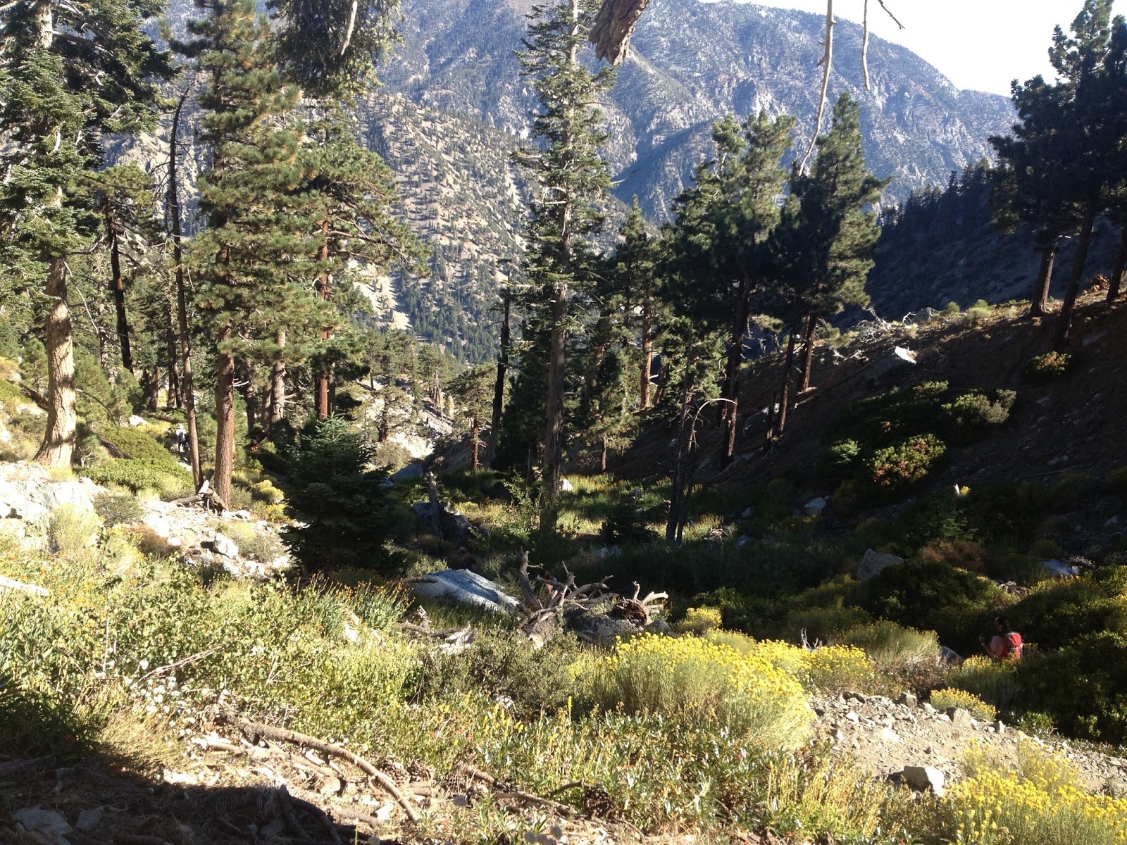
Coming out of the Ski Hut area I cross the creek, which is running well, and head across what looks like an old rock slide boulder field at the base of the bowl. The trail is level here and the comfortable walk lures me into false hope that the hike to the top will be easier. That idea is rapidly dispelled when I reach the canyon I I need to climb, which look more like a drainage channel than a trail.


Finally out of the canyon and on the ridge I sit down to catch my breath. I met a man who was following me up and we share our thoughts on that section of trail.
"That was ridiculous" I say.
"I'm ready for a nap" he replies.
We talk of the fires looming in the distance and our training regimens. He and his group are prepping for a High Sierra trip and I of course, for PCT.
I bid him good day and continue up the ridge and around the back side of the bowl.


Challenging and unintuitive are polite descriptions of the next section of trail. Really, it was kind of a bummer. The braiding and degradation of the route was not only upsetting but bordering on dangerous.
The name sake of this peak: San Antonio (Saint Anthony) is the patron saint of lost items and people. He would be good to invoke here to keep you from getting lost. I felt bad knowing that I was adding to the degradation of the trail by following routes that appeared to be trail but rapidly turned into channels and scree fields.
I really think this hike should be permitted and regulated to give the mountain time to heal.
We are way passed "Don't cut the switch backs" signage here.


Finally in the home stretch! The awkward and ridiculously steep climb has taken the wind out of me. I am now taking about ten steps and stopping to lean on my poles and die a little. Ten step...die...ten more steps...die.


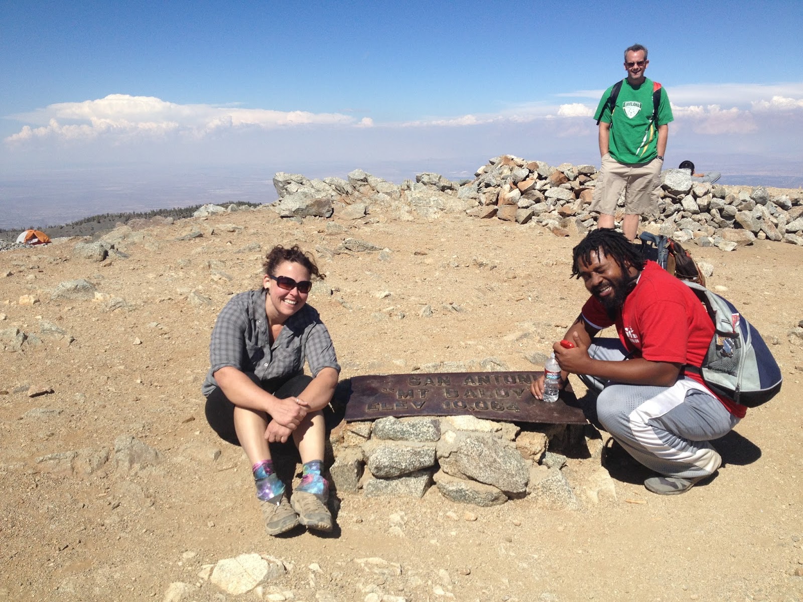
Focusing on my 'ten-steps-and-death' type pace for a long while, I finally look up and realize I'm on top of the mountain! HA! I've made it!


I drop pack and cruise around the large domed peak. There is a fire in the canyon below the Notch restaurant and behind the Devil's Backbone trail and I watch helicopters drop fire retardant on it.


I pulled up a rock and ate some trail mix, happy that I have finally bagged this peak.


In the distance you can see tons of smoke hanging on the bottom of the Cumulus clouds from a fire in Wrightwood.

One group is climbing up from the Devil's Backbone side and stop at the sign. They ask me to take a photo of them, which I do, and they in turn take a photo of me. We chat and take photos together, I gave them some stickers for the blog and I hope they are reading it now.
HI GUYS!!
Leave me some comments if you've stopped by!

I pack up and head back the way I came. The trail on the way down seems to be a little easier to follow but still a slippery slope. I meet with a group of backpackers on their way up and they warn me of that same Southern Pacific Rattlesnake. He was very rude to the folks at the hut, apparently.


I leap frogged a group of young folks, who's descent consisted of a balls-out run down the mountain and a bone crushing slam into a tree to stop their fevered pace. My knees cried out for them! I over took them for the last time at the hut and won our game of downhill tag.
Back at the register I update my entry with confirmation of summit and head to the road.


I meet the group of High Sierra training backpackers and we trade trip totals. They made it to the top of the bowl on this trip. Hike on guys!

Back at the truck, I take off my shoes and head down the mountain for a well deserved ice cold Diet Coke. It was a hard hike! I am glad to check it off the list.

Trail Stats:
10,064 foot peak
3,900 feet gain/loss
9 new friends
5 miles
2 blue tailed skinks
1 more off the list
Good Times!
I finally logged on and checked out your blog! Very cool... Love the pix and honesty :)
ReplyDeleteJulia
Thanks Julia!!
Delete