Labor Day weekend, my little brother Eli and I went to San Gorgonio. This is Eli's very first backpacking trip, and while we were excited to get out on the trail, I was sad to go without Josh. I know he is getting stir crazy not being able to hike after surgery.
Eli is a goofball and kept me pretty entertained for the duration of the trip.
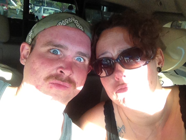
We text Josh this picture and headed out toward Redlands.
The weather called for rain and thunderstorms with epic heat, but we went to check it out anyway at the urging of a few people on the SGWA bulletin board. The sunset on the way there was beautiful and we had just missed a downpour in Temecula.


After a few more hours of driving we arrived at Heart Bar Campground off Hwy 38 and proceeded toward the horse camp. We followed the nicely maintained dirt road passed the horse camp to an open metal gate. Here the road begins to climb toward the Aspen Grove trailhead and on to Fish Creek trailhead at about seven miles. The road was in better condition than I thought it would be after all of the rain, with only a few washed out spots.
We officially arrived at the Fish Creek trailhead at 10pm. We parked and ate some dinner before retiring to the back of the truck for the night.
The next morning we wake around 6am. Cars are already filtering in to the parking lot where folks who got much better sleep than us, are jumping out and head up the trail. Eli and I drink copious amounts of coffee to combat our fatigue from a night full of epic snoring (him) and relentless complaining about it (me).
Oh, the joys of brother/sisterly love...


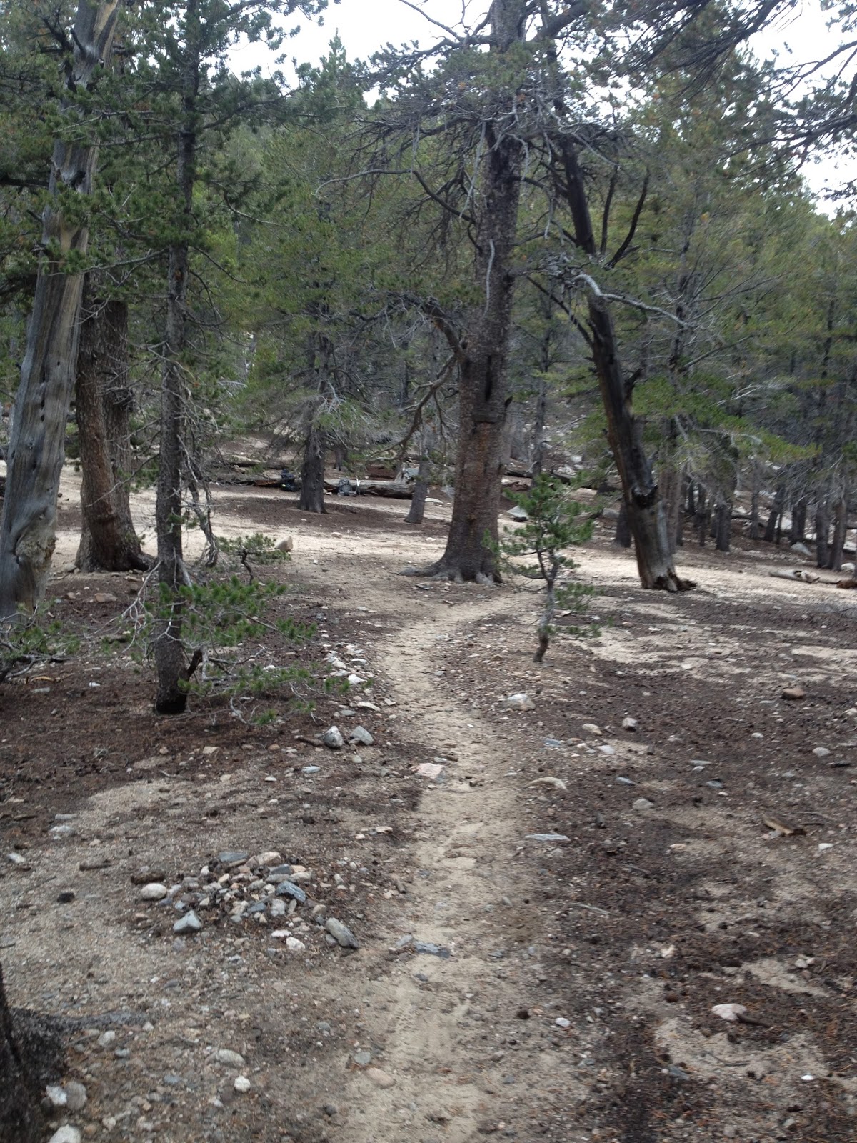
At last we hit the trail at 7am and start our decent toward Fish Creek Meadows.


We reach the junction for Fish Creek and Aspen Grove trails at just shy of a mile in. Aspen Grove is the home of the only grove of Quaking Aspens south of the Sierra Nevada. It is a beautiful trail, especially in the fall when the leaves change color. Starting your hike up Fish Creek via Aspen Grove will shave 5 miles off your drive but add 2.7 miles one way to your hike.

Continuing on, we cross our first creek which is only a trickle and make our way to the meadow. I have to stop and adjust my pack load here. This trip is the maiden voyage for my new Gossamer Gear Mariposa Backpack and I fear it is not going to be a good fit. I make the necessary adjustments while eyeing my trusty GoLite pack on Eli's back and hope for the best.


After the meadow the trail ascends and follows the hillside with long winding switchbacks and hairpin turns. We come to the junction sign for Fish Creek Camp and push on passed it toward the creek, which is the water source for the camp. I've named this area Flat Rock as there is a large boulder at the waters edge that is, well, a flat rock. It is a good place to drop pack, resupply water and eat a snack before rising out of the tree cover and onto the ridgeline.


We begin our climb toward Fish Creek Saddle and watch as the clouds get dark over Lake Peak and Ten Thousand Foot Ridge.


Winding in and out of tree cover and the exposed ridge line, the switchbacks are so long you don't even recognize them as such. It gives you a sense of deja vu as you pass through scenery that looks the same, albeit higher up.


Our camp is on the other side of this ridge. We watch as the surrounding peaks become shrouded in clouds and perk our ears as we listen to thunder in the distance.


Rounding a corner at the base of Grinnell Peak we catch our first glimpse of San Gorgonio and Jepson peaks looming above the saddle. Inspired, we pick up the pace and climb the final leg to Fish Creek Saddle Camp where we sit for a snack.


While eating we try to formulate a plan for the rest of the day. We are now only a mile or so from our camp and it is still early in the day. I would like to climb Lake Peak and some of the Ten Thousand Foot Ridge on this trip and it looks as if this is the best approach. While checking our supplies the thunder starts to growl, loudly. My better judgement trumps my peak-bagger eagerness and we take off toward Mineshaft Saddle to set up camp before the storm.


At the junction we hike fast from the saddle, down the canyon toward Mineshaft Flat and Big Tree Camp.

Upon arrival to the camp the storm seems to peter out and move away. We seize the opportunity to set up the tent and get ready for the weather to change again. I've heard the saying goes: If you don't like the weather in the mountains, stick around, it will change.


Now, I know what you're thinking...uh, Mandie, that tent doesn't look like it's set up correctly. Well, you are absolutely right, it's not. After my tent was mauled by a bear on the Momyer trail, I had to rent a tent from REI. I neglected the first rule of new or borrowed tents...set them up at home first to make sure they are in good repair and you have all of the stuff. When we tried to set it up it was A) NOT an intuitive design and B) the poles were bent beyond beliefe furthur adding to the confusion. We got it standing, put on the rain fly and dubbed it "The Jalopy Tent".


With camp (sort of) set up, we walk down a third of a mile toward Big Tree camp to resupply our water. When we arrive the creek is more overgrown than I remember it and there are two gentlemen resupplying at different gaps in the foliage. We say hello and try to find another accessible point to fill our dirty bag. Heading down into the creek bed proves to be more of a challenge then we're wanting to embrace. We notice some left over plane wreckage from a crash long ago by the stream and turn back to where the guys are filtering. I ask if I can use his area to resupply to which he obliged. We chat briefly about the topography of the desert below until our water is full where we bid them good day and head back to camp.


Camp chores completed we decide to explore the area. We try to climb the face of an unnamed peak to investigate a rock pile on the ridge that looks like remnants of an old mine. We try several different approaches but are denied access by the overgrowth of super sharp buckthorn.


The sun starts to hang low in the sky and we return to camp to eat dinner and relax. Eli is a little discombobulated trying to figure out what to do with himself with no distractions and asks me a few times if I have cards or something. I tell him no, and that I am accustomed to just sitting in the quiet. I understand his restlessness, as I was there too when I was a new backpacker.


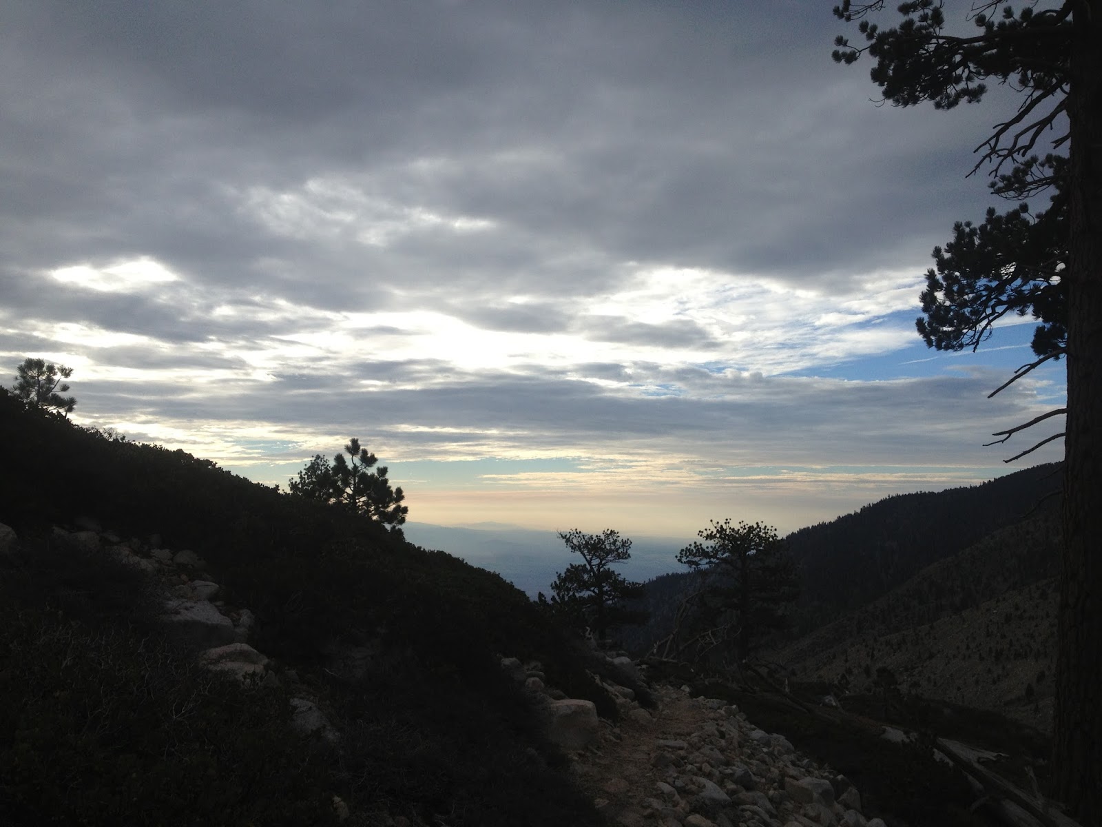
The sun drops behind the mountains and it starts to get cold. We go to the tent to set up our beds and dawn our warm clothes before watching the sunset.


And what a beautiful sunset it was.


After a long night of flip-floping we wake to a sunrise that is as beautiful as the previous nights sunset. Eli however is only mildly impressed. It was an uncomfortable night for him.


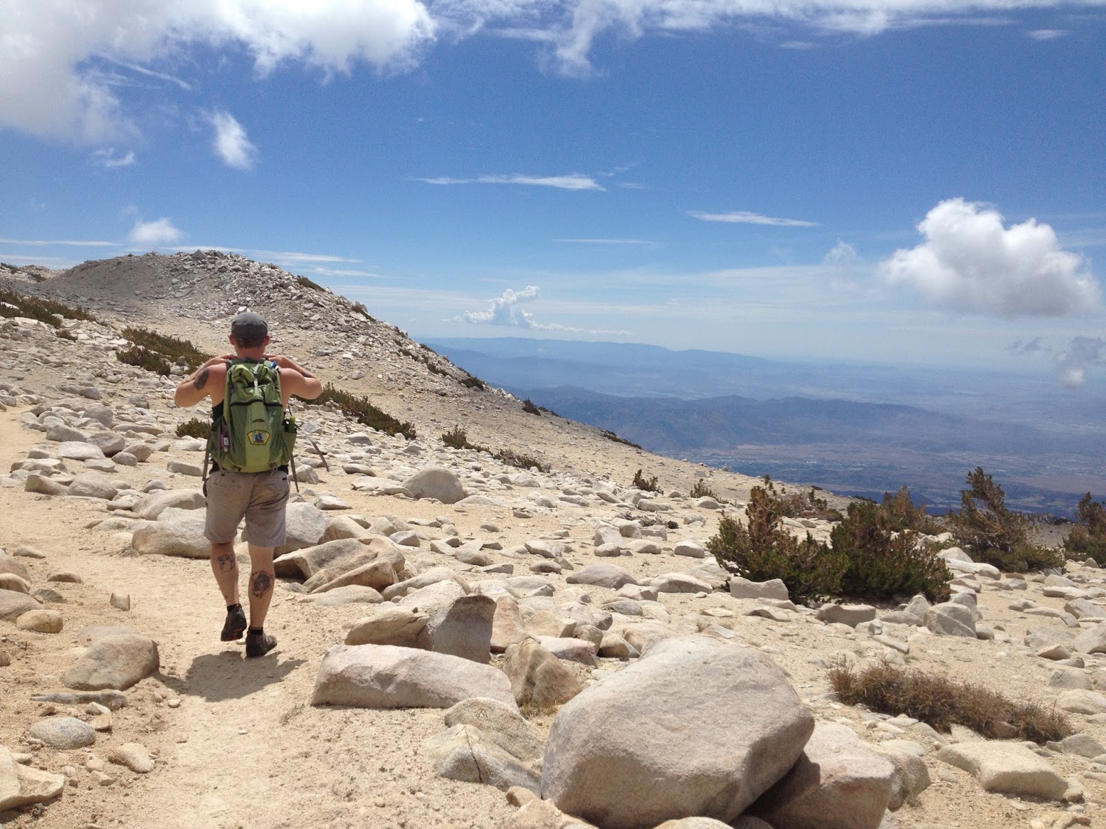
Today, we plan to summit San Gorgonio. I cook breakfast and prep our gear while Eli heads down to get more water. If you look next to the pine tree in this photo you can see him hiking up the trail. Scale is everything. The wilderness is huge.

Taking in the views and warming up our muscles, we climb out of the the canyon toward the saddle and the Sky High Trail.
Now, we all stink when we backpack but only little brothers will stick your face in their armpits. blegh.


At the saddle below Trail Flats Camp we eat a snack and watch the chickadees eat termites before heading up the switchbacks.


Climbing the next four miles to the summit we keep our eyes peeled for big horn and other wildlife. The day is already hot and sticky but beautiful!

We stop and survey the wreckage of a C-47 that crashed in the 50's killing all on board. The vibe is palpable here and I always wonder if there are bones in the wreckage.


Eli loved this tree. He said it reminded him of Sloth from The Goonies. We continue to climb the switchbacks watching our camp get smaller and smaller as we ascend.


Finishing the last switchback we round the mountain and views of San Jacinto, The Dragon's Head and The Tarn prove we are almost there!


We couldn't have asked for a more beautiful day. Arriving at the junction sign Eli looks like he's waiting for a bus. Less than half a mile to go.


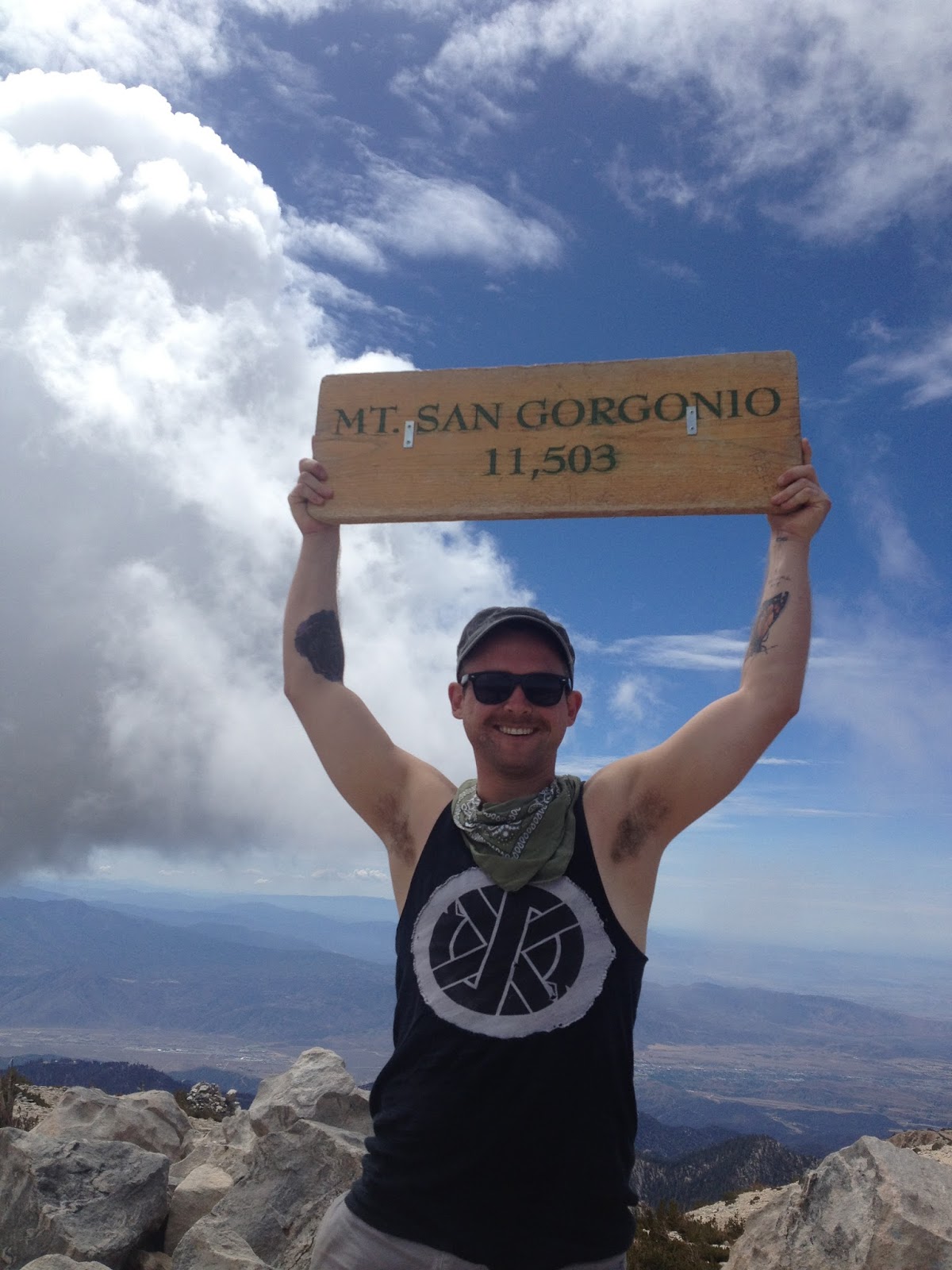
The final push and we are on top! The summit is crowded and a group has decided to take a break ON the register box. Luckily they are packing up to leave so we wait patiently, instead of booting them out of the way.
Dear Fellow Hikers,
When you summit a peak, don't take it over. Put your stuff out of the way, Sign/read the register without blocking access to it, take your pictures of the markers and what not without making a scene and eat your lunch somewhere else.
Thanks.
Sincerely,
Socially Awkward Hikers Everywhere.
:-)

Finally we gain access to the box and I put my sticker inside. We both sign a book and move to the top for the obligatory summit photos. This my 5th time on top and Eli's 1st. Always a great accomplishment.


We move down the ridge toward the rock tent rings and watch the clouds form while fending off over zealous chipmunks.


The clouds looking ominous prompt us to start our descent back to camp.
Once back at camp Eli discovers the importance of frequent snacking while hiking. He hit the wall and officially turned into a cranky diva. We cooked up some mountain house fajitas and he was much better. After eating Eli finally admitted he couldn't hack another night in the tent. Seeing as it was his first ever trip, I was ok with going down early. We packed up camp and proceeded to race the sun down the mountain.


At about mile 17 for the day I was hurting, having given him the last two Advil at flat rock.


The final ascent complete and we see my truck in the distance. We have beaten the sun and hiked 18.5 miles for the day. Not bad for a newbie backpacker, Eli!


After the obligatory feet photo, we head down the mountain to have a pizza dinner with our little sister Whitney.

Great hike!
26.7 miles total
Bagged the highest peak in So. Cal. with my smelly little brother
Great weekend, now on to the next!
Another great post!
ReplyDelete