I was supposed to hike down to Three Sisters Falls on this day to clean up some graffiti, but while jumping through the hoops required to register as a volunteer with the Cleveland Natl. Forest, some kind trail steward had beat me to it. I can't really say I'm all that heart broken, that trial is not for the faint of heart! Having a beautiful day at my disposal I headed back out to the desert.
And guess who joined me... Josh! He decided to give being my friend a shot. We were in search of the waterfall I attempted to find on New Years Day in upper Hellhole Canyon, north of the Culp Valley campground. With two heads navigating we were able to find the correct ridge to climb to access the canyon. Once on top of the hill we found the canyon was deep. REEAAALLLYY deep. And decided it was probably not the best hike for Josh to try and get his trail legs back.
We abandoned the waterfall hike and decided to cruise around on the ridge line as it descends toward the west fork of Hellhole Canyon. I was looking for bench marks on the boulders as I've read there are a few in these rocky hills but all we found was a neat rock grotto and copious amounts of cholla.
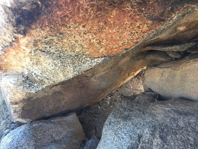
Once we reached the end of the ridge line we descended down a steep cross county slope that we named "hold my beer ridge" as in, hold my beer while I do something stupid. At the bottom I noticed a little rock shelter that looked as if it had been recently used by an animal. Upon closer inspection I spotted something shiny wedged between the rocks.
I stuck my trekking pole in and fished out this beauty. I don't think I've never found an intact pelvis before. I emailed the Anza Borrego Foundation when I got home to see if they knew who it belonged to but they never responded. Do you have any ideas?
I put the pelvis back where I found it and Josh and I cruised to the top of the canyon to see if there was anyting else interesting to see. We decided it would be fun to set two cars one day and do the canyon in its entirety. However, today was not that day and I had to use the bathroom so we headed back up to the trailhead. Somehow the trip out of that little valley is always tough! It doesn't look like its all that strenuous but it takes the wind out of me every time! I'd like to go back and camp at Culp Valley some day to do some more exploring on those ridges.
After Culp Valley, Josh expressed interest in seeing the Pictographs at Blair Valley. I love that place so I drove us back to the S-2 and down the dirt road to the trail head. On our way out we met a coyote who feigned a limp in order to garner sympathy from us and hopefully a snack. We did not oblige but we did enjoy watching him put on his act.
Since I've been here before, and I'm doing the Explorer version of the 52 hikes which requires you explore new areas or routes, I'm adding it on to the Culp Valley trip instead of letting it stand alone. However, this trip experience did turn out to be different for me, as I got to see it through Josh's eyes and a nice gentlemen we met at the Smugglers Canyon dry falls. The man we met was from New Mexico and we exchanged information about Anza Borrego and New Mexico local tribes. His theory about our pictographs was that they were an illustrated map indicating an area of agriculture or farming. Even though the Kumeyaay were nomadic, this rang a bell for me knowing that we were one canyon over from the mortrero trail which is known to be a sort of kitchen for the Kumeyaay on their travels. The mortero trail has everything from agave roasting pits to pictographs as well as, you guessed it, mortreros. Thinking about the pictographs in this way made them click for me and I felt a new understanding of the area.
Since I've been here before, and I'm doing the Explorer version of the 52 hikes which requires you explore new areas or routes, I'm adding it on to the Culp Valley trip instead of letting it stand alone. However, this trip experience did turn out to be different for me, as I got to see it through Josh's eyes and a nice gentlemen we met at the Smugglers Canyon dry falls. The man we met was from New Mexico and we exchanged information about Anza Borrego and New Mexico local tribes. His theory about our pictographs was that they were an illustrated map indicating an area of agriculture or farming. Even though the Kumeyaay were nomadic, this rang a bell for me knowing that we were one canyon over from the mortrero trail which is known to be a sort of kitchen for the Kumeyaay on their travels. The mortero trail has everything from agave roasting pits to pictographs as well as, you guessed it, mortreros. Thinking about the pictographs in this way made them click for me and I felt a new understanding of the area.
When the day was all said and done we had done about 5 miles and had a lot of laughs. It was nice to get out and hike with Josh. If there is one thing we do well together it's hike and I really enjoyed his company. I hope we will be able to do it again soon.


This is a really nice hike. Standing on top of the dry falls at the end, is pretty cool.
ReplyDelete