Showing posts with label San Diego. Show all posts

Thursday, August 24, 2017

Grasslands and Dams

I'm trying to get the gazzilion extra pounds off that I put on over the last couple of years, so Josh and I are picking up the after work hikes again.  We headed over to the north side of Mission Trails in search of some lesser visited Kumeyaay sites. We started out slowly on Father Junipero Serra road on balmy summer evening. We passed a Ranger led guided tour exploring the flora and fauna of Kumeyaay Lakes before turning down a concrete path that crossed over a stagnant San Diego River. The vibe in the overgrown river grotto felt like a bayou and gave me flashbacks of my recent visit to Tennessee. 

We climbed out of the river gorge, passing large stands of blooming Datura and vines heavy with wild cucumber before topping out on a beautiful grass prairie. The atmosphere was thick and heavy as we followed the trail under pastel skies. 


At the edge of the prairie was a generic brown trail sign pointing the way to an outcropping of bedrock boulders labeled as grinding rocks. Josh and I diverted from the trail, which was likely a fire road in the recent past, and meandered through the dry brush that filled our socks with stickers and seed pods. Once at the bedrock island, we found a beautiful set of oval morteros which I've learned are called Cuyamaca Ovals.


It seems these oval shaped moretros are primarily found in the Peninsular range and are most frequently located next to prairies and meadows. It is theorized that the type of seed or grass collected here required a back and forth motion to process, resulting in the oblong shape.

Josh and I surveyed the area for a while and chatted about how we take our natural landscapes at face value, thinking they are solely the work of environmental phenomenon. It's only after delving into archaeology that I've discovered that a lot of what we see on trail is not necessarily "natural", but rather, was selectively designed by our predecessors. It is likely that this particular grassland was cultivated, managed and maintained by the Kumeyaay over decades in order to resemble what it does today. I sat quietly for a time while Josh poked around in the brush, and ran my finger along the edge of a stone divot as smooth as silk. I scanned the horizon of this brittle field that'd gone to seed and thought to myself, this is actually a prehistoric garden.

The sun was rapidly retreating behind Fortuna ridge so I snapped out of my musing and followed Josh south to complete our grassland loop traverse.

We descended from the mesa via several steep stairs carved into the hillside and reinforced with wood 2x4's until the trail vanished into Oak Canyon Creek, a tributary of The San Diego River. After slogging through the soft sand of the dry creek bed we met with an overgrown trail that led to the western flank of Old Mission Dam. 

After pushing passed low hanging sycamore branches and avoiding baby buffalo gourds under foot, we arrived to the dam. This rocky structure was dreamed up by the Spanish and constructed by the Kumeyaay in order to provide reliable water to the colonies and missions in the area.* Today, it seems it collects more visitor trash than water and Josh and I packed out an abundance of aluminum cans and debris.

Instead of walking across the dam we opted to go around and search for more signs of history in the wash. Just as we were about to cross over the river I noticed several layers of archaeology on the banks. Resting on top of each other in situ was a rusted, gunshot riddled vehicle quarter panel on top of a bedrock boulder speckled with shallow Cuyamaca Ovals. I admired this display in the ambient light of dusk and decided archaeology is not static. Whether we realize it or not, we do not passively observe it, we live it and add to it everyday. Or, I might just be overthinking things...It's advisable to bring a grain of salt on hikes with me these days.

The smell of raw sewage stung my nose as we walked single file over the flume toward an empty parking lot.  I wasn't ready for the hike to be over and I meandered through the shoreline boulders looking for more points of interest until it became too dark to see.  All in all, we put in a couple miles and successfully worked off some excess calories while giving our existential brains a workout in the process. 
It was a great after-work hike.


Friday, August 18, 2017

San Dieguito Lagoon

Holy wow, I'm so behind on writing! Hold on, we're going back in time!

I was so focused on my fast-track summer school class that I wasn't doing anything other than reading textbooks. I finally decided I had to carve out some time to get outside and drove up the coast on a gorgeous June day. I stopped on a whim at the San Dieguito Lagoon trailhead off of Via De La Valle in Del Mar and set out along a dusty and exposed service road paralleling interstate 5. I came to a bridge and stood in the cool shade while watching swallows fly in and out of mudhuts underneath, their babies poking their little heads out anxiously looking for food.

The trail is not exactly a nature experience, although there was plenty of flora and fauna to observe. The freeway noise was constant and the screams of children on carnival rides at the Del Mar Fair filled the air. I walked slowly admiring a variety of spiderwebs, bugs and crabs on the marshy banks of the river. In the Del Mar parking lot the overhead lights had large nests woven on their tops, and shortly after discovering them I spotted an osprey perched on a wire surveying the area. While I was ogling him through my binoculars a family on bicycles rode by and bid me a pleasant hello.

I was in awe of the iceplant on the banks of the river. I've never seen it so sparkly before! It looked like sour punch candy coated in sugar! Eventually the plant life gave way to sand and I observed several large fish and a group of jellys riding the tide into a protected slough at the end of the trail. In the distance men were surveying for new trail additions that will hopefully complete the Coast to Crest trail. I walked to the end of a series of boardwalks before turning around and returning the way I'd come. As I neared the trailhead I heard something large in the bushes and spotted a homeless man pulling his bicycle out from under a tree. This, I thought, is urban hiking. Not my favorite but it'll do for today. Any feelings of nervousness I had being followed by the man on the bike were quickly forgotten when I noticed a large boulder pocked with seashells near my truck. It's always fun to find fossils!

While it wasn't a very remote or spectacular hike and while I certainly miss my artifact hunting, it was a nice break from schoolwork and it was cool to check out an area I've never been to before. I think I would like to do the Coast to Crest trail when it's completed, and the San Diego Trans County Trail one day too!

Friday, March 3, 2017

Rock Hill Trail, Salton Sea

We had a serious downpour in San Diego County and the news said it rained for something like 22 hours straight! Luckily the skies cleared for my day off and the drive east on I-8 knocked my socks off! The hills were like a sieve! There was water gushing from every nook and cranny in magnificent cascades the likes I've never seen before.

My goal was to go back to Anza Borrego but when I arrived I was physically exhausted for no real reason. I got about a third of a mile in and decided maybe today was a 4x4 recon day. I jumped back in the truck and pounded some coffee hoping it would work it's magic while I checked out some new areas. I drove back through Ocotillo to the Chevron station south of I-8 and felt the urge to continue to Hwy 98. I found a bunch of interesting places I've read about in other blogs, like The Crucifixion Thorn Natural Area and new plateaus in the Yuha Desert, and before I knew it I was in Calexico. 

I continued on the 98 east and resigned myself to go all the way to Yuma and maybe beyond. I told myself, I have camping gear, a credit card and two days off so why not. I went until road work presented a detour on I-8 that made me double back almost to where I started, so I left Arizona for another time and just drove aimlessly west-ish. I exited the freeway and merged on to Hwy 86 which heads into the Coachella Valley and thought maybe I'd go to that desert and do a trip down memory lane. By this time the giant coffee I drank kicked in and made me have to pee so I stopped in the little town of Westmorland to do that and get gas, since I was clearly in the wind. As I exited the gas station parking lot I noticed signs for the Sonny Bono Salton Sea Wildlife Refuge and my truck turned itself in that direction. I passed several geothermal plants and farms over grown with some type of vegetable that was blooming yellow flowers until finally arriving to a round-a-bout parking area at the Refuge.

As soon as I got out of my truck the sound of birds and the smell of funk filled the air. While reading the information kiosks I saw a sign for the Rock Hill Trail which said it was just one mile long. I can do that, I thought to myself while grabbing my backpack and binoculars. The trail is really just an old ranch road lined with native plants and more informational kiosks. I cruised along, checking stuff out and feeling glad that I stopped.

The trail climbed up to a spillway on the All American Canal and turned north toward what I guessed was the Rock Hill, seeing as it was the only hill in the area.


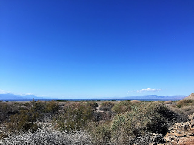
All this time I was expecting to see the Salton Sea was on my right so it caught me off guard when I realized it was on my left! I guess I am further east than I thought I was.

The trail turned into a catwalk between the Sea and a brackish water slough surrounded by salt flats. I looked through my binoculars at the variety of birds, and remembered admiring the same types of birds with Josh at Lake Arrowhead one year.

I climbed the tiny section of incline to the top of Rock Hill and sat on a bench, taking it all in. If I didn't tell you this was the Salton Sea I could easily pass these photos off as my neighborhood in Ocean Beach. This lake blows my mind every time I visit, and I've been coming here since I was a little kid. While I sat there I remembered being on a school field trip in second grade maybe? I filled my lunch box with what I thought were seashells, only to have my mom get mad at me when they stunk up the house. Turns out they were barnacles, not seashells. Oops. One of the informational kiosks told me barnacles were introduced here during WWII when float plane pilots were practicing their landings and take offs in the sea. The barnacles were stuck to their skids and found a nice home in the lake and have since over run everything that is built near the shore.

While I surveyed the area from the higher vantage point, I thought about this terminal lake and how devastating it would be if it dried up. It already smells like a thousand buttholes in the summer and the thought of it turning into something like the Owens Lake makes me shudder.

On my way back toward my truck I heard fighter jets passing over head and looked up to see three flying in formation. Shortly after I watched as three pelicans took the same formation and wondered if they did it on purpose. 

The birds aren't the only creatures living here; a little cotton tail popped out of the bushes to say hello.

The mud from the recent rain preserved the footprints of the other, more secretive critters, like this bobcat. I learned recently that bobcats and mountain lions use what is termed 'direct register' in their gait. This means their back feet step nearly directly into their front feet's tracks. This aids in traction like having kicked steps in snow. These tracks are examples of an indirect register gait which probably occurred because he was slipping around a bit in the mud. At least that's what I think is going on here. Keep in mind I'm only google educated.


The more I looked at the ground the more critter tracks I saw. I think this is from a racoon.

And I think this is an Opposom. I never realized they have opposable thumbs, did you?

For what looks to be such a harsh environment, it is teeming with life.

Back at the trail head I checked out the visitor's center and the beautiful garden of native plants around it. Flower season is here, guys!

I was still feeling off and decided to head home. I continued on Hwy 86 and after being questioned by the border patrol at a checkpoint turned left onto Hwy 78 in Ocotillo Wells. There I saw a helicopter hovering really low to the ground and when I turned my attention back to the road, saw an agent dressed in full military gear walking on the shoulder. I thought back over the day and realized I had seen 4 agents on ATV's near the town of Ocotillo, a border patrol vehicle with lights and sirens stopped on the side of I-8 with agents climbing down a ravine. Something must be up I thought and later discovered there was a huge bust in North County, so maybe that had something to do with it.

I made my way across the desert on Hwy 78 and drove over the bridge at scissors crossing where my jaw dropped to see a ton of water in the San Felipe Creek. I pulled a u-turn to get some pictures and found the water caches have already been set up, but class of 2017 may not need them with the season we've had. I have never see water in San Felipe Creek. It was a beautiful sight!


As I continued up Banner Grade I saw road crews trying to remove a boulder that was 10 feet tall and as wide as the eastbound lane. The whole area has been reshaped by mudslides which is interesting to see. 

So, while it wasn't my longest hike at only about 2 miles, it was still a fun one and I saw a lot of cool places I'm planning to return to.

Friday, February 17, 2017

Rock Climber's Loop

Believe it or not, there are a few trails in Mission Trails that I haven't done and the Rock Climber's Loop is one of them. Its a short hike, only about a mile and a half starting from Josh's house.

Yeah, from Josh's house...we were trying the friend thing again and met at his house after work, heading out to the trail around 4pm. Josh brought his big camera and took a lot of great photos which I imagine he'll post on his blog soon.

I was feeling good and actually flew up the steep trail, well, flew up by my standards anyway. The views from up here are really beautiful and the rocks were spectacular. They don't look nearly as magnificent from the road as they do close up. When we finally reached the top of the trail we walked the crest of the mountain and chatted with some rock climbers who were super nice. I like rock climbers! I've yet to meet any that are pretentious or egocentric, which is kind of what I expect of them since they are such badasses!

After a couple of fun scrambles over slick boulders, the trail headed back down toward the road. Looking at all of the new grass and plants on the hillside made me so excited for spring! Everything is so green and there is so much water, the flowers are going to be amazing,


On our way back to Josh's house we poked around and found some impressive groves of wild cucumber and observed a sharp-shinned or coopers hawk on a light standard.

This is a super fun, super short hike that 's perfect for after work. Next time I go I'll bring a pair of binoculars so I can get a good look at the river bed from that vantage point. As for Josh and I...well, this hike was fun, but things got complicated again soon after and we are back to just the occasional email. I wish it would work between us because I miss my friend, but I think relationships are like farts; if you have to force it, its probably shit.

Saturday, February 11, 2017

Morena Butte

When I left the house to hike I wasn't really sure where I was going. I headed east on I-8 and made a pit stop for gas and hiking snacks at the Cheveron on Alpine Blvd., as I always do, and there it hit me: lets go do Morena Butte! I felt kind of excited to go see my friend, the PCT. I've been thinking about the trail A LOT the past few weeks so it would be nice to finally be back on. When I arrived the day was beautiful and I parked on the side of the road just outside of Morena Lake Campground property.

It was kind of weird to be going south on this section. I have done it so many times I know it like the back of my hand but heading in the opposite direction gave it a new novelty. I kind of huffed and puffed heading uphill and used the information markers as an excuse to catch my breath. Lake Morena used to fill this reservoir but The City of San Diego decided to divert the water to Otay Lakes leaving Morena mostly meadow.

After more uphill my destination came into view, Morena Butte the a red hued beast loomed in the distance. No matter which direction you come from it is the mark of hard hiking. When it comes into view from the other side your heart kind of drops knowing you're going to have to drop down to its base and then climb out after having done 15 miles and still having more to go.

As the trail climbed higher I was able to see a bit of water in the reservoirs from all the rain we've had this season. The class of 2017 is in for a real treat in the desert this year, as all the tributaries are flowing and there is water running right thru the trail in this section that is notoriously dry.

The recent rains also left a record of the local residents, and I stopped to check out cougar, bobcat and deer tracks in the mud. After following the cougar tracks for a ways I came across a good sized pile of cougar scat that I promptly poked at with a stick.


The trail came to an odd junction that I'm still not sure about. I consulted my map but it wasn't any help so I decided to keep going on the PCT as opposed to investigating this other side trail. One day I'll come back and check it all out.

Soon the trail turned into a creek bed and it made me think of the Class of 2017 and how much water they're going to have to deal with this year. Here in SoCal I think it will be wonderful but the Sierra is going to be nuts.

I dropped into a dry creek bed just before the pass leading into Hauser Canyon. There was another trail junction here which I think goes to the dam.


At the top of the pass I sat on a boulder that Josh and I had sat on many times before both on day hikes and on our section hike and I reminisced about the PCT. My musings were interrupted by a rustle in the bushes next to me and I was startled to see a man pop out of the brush. He was dressed all in black and told me he had seen me come down the ridge. I laughed and told him I hadn't seen him at all and that he scared the shit out of me! He smiled and told me his hiking partner has done that to him once or twice out here and it was then that I noticed he was with the Border Patrol. We chatted for a while about the PCT and Morena Butte and he told me he was setting up trail cams at various points along the border. He explained that sometimes animals trigger the alarms and it takes a lot of resources for agents to investigate, so with the cameras they can check remotely to see if it was a human or an animal that tripped the sensor. He was a very nice guy and his enthusiasm for his job was contagious and when we parted ways I was feeling pumped about climbing this butte! 

That is, until I started climbing and found it was so steep I had to use my hands in some places! Holy shit! I did my standard hike 5 steps and rest pace until the trail ran out of hillside temporarily.


I walked a small ridge line below my next challenge and it reminded me of North Fortuna. Already the views were amazing and on such a clear day I could see for a long way into Mexico.

As I neared my next climb the brush got denser and the granite more abrasive and I smacked my elbow on a boulder. Since my elbows are broke out with psoriasis right now it exploded and bleed everywhere. I had this happen on another trail recently and I am always glad to be out there by myself so no one will see what looks worse than it really is!

Soon the trail dissolved and I was navigating completely by cairns. I climbed and climbed and eventually found myself heading toward the backside of the butte.

After making my way to a narrow plateau I came across this cave that is undoubtedly home to a cougar. This is just the patio portion of the cave, the rest of it went deep inside the boulder structure. Normally this would cause me to feel afraid but I didn't. I don't know if it was being back on the PCT but I felt surprisingly calm and happy on this whole hike. Maybe I'm making progress!


Not far from the cougar cave was a convenient water source. I dodged slick collections of algae as I continued up the hill.

The brush gave way to large granite slabs making the cairns more difficult to spot. I consulted my gps for my location in relationship to the highest point and found I had passed it on the back side.

Finally, I just blew right up a large boulder field with a 'lets get this shit done' mentality and popped out on the top of the butte with 360 degree views of awesomeness. 

I spotted a high boulder and ascended it rather ungracefully, again feeling grateful I was the only one up there to see me. I found a register inside an old first aid kit  that was wedged in a crack in the rock. The register was just a 1/3 of a pocket sized memo book but there was enough room for me to sign. Josh told me later that he was going to climb up here so I told him to bring another book, and he did, so there is something for you to sign should you decided to climb it too.


While meandering around the summit looking for benchmarks I stumbled upon this feature in the rock. I touched the edge and it seemed to be set inside. I was wondering if it was a fossil and emailed it to the archaeologist I met while on Ghost Mountain. She is going to forward it to a paleontologist but another friend of mine said it was probably just an old mud dauber nest. Either way it's kind of neat looking!

I ate some lunch and considered hiking to the other high points but I was near the end of my water. I decided to save them for another day when I explore those other trails, the dam and maybe ascend from the other side.

The boulders up here gave me high Sierra vibes even though the granite was different. I love this bizarre landscape.

I also noticed large crystallized chunks of quartz in the soil covered sections. The quartz was beautiful and sparkly having just been cleaned by the rain.


On my way back down to the PCT I met a pair of Ravens who looked at me curiously. I gave them a couple of clicking noises and they responded with some enthusiastic head nods.


As I arrived back on the PCT I met the first thru hiker of the season resting on the side of the trail. I thought he might be a southbounder but he said he was northbound and just getting an early start so he could take his time. We chatted for a bit and he gave me two trail names, both of which I have now forgotten. (I have to write this shit down!) I headed on before him and told him I was sure we'd meet again, and we did as I was taking a break on a boulder. I looked down inside a crack and saw what I thought was a mandible. I was fiddling with my phone to take a photo of it when the Nobo arrived. "You don't have serivce out here do you?" he asked. I told him no, that I was just taking a photo and reached in to get the bones to show him. When I pulled it out I realized it was an intact skull of a squirrel. I told him I always find dead shit on my hikes and he said that was a good thing because it means there is live shit out here too. I like that. It kind of gave me a different perspective and something to think about for the rest of my hike.


I played tag with the Nobo for a while, finally leaving him to his thru just before the end of the trail. I headed out of Morena on my way home and stopped at the rest stop between the freeway off of boulder oaks road. When I arrived, the parking lot was relatively empty and I pulled into a random parking space to find a dime right next to my truck. I love finding dimes in weird places like this because my mom always said when you find a dime it's God's way of telling you you're on the right path. I feel like I'm on the right path again. It feels good.

All together it says I did 9.17 miles. That's a new record for me since the arthritis! I'm getting my legs back! Yay!