I knew Josh and I couldn't go on like this forever and we finally met at the crossroads, inevitably deciding to cut it off completely.
Feels bad, man.
After that conversation I had to get out of my apartment and into a wide open space to let the energy disburse.
I headed out to Anza Borrego and followed a wash toward Font's Point. The view did not disappoint and I spent a long time just sitting in the open trying to let things go. Maybe it's a big mistake on my part, only time will tell. I know no one will love me more than him, but I also know someone will love him more than I'm capable of, and honestly, that is more important to me.
In order for that person to arrive for him, I have to get out of the way.

I pushed thru the week, trying to stay busy at work, and on the eve of my day off I told myself that the next day I would go out for a super long, solo hike. Then, for some unknown reason, I proceeded to spend the next 2 hours sitting in the dark by myself reading a variety of graphic stories on message boards and blogs about local Mountain Lion sightings and attacks.
While this was not conducive to an enthusiastic solo hike, it did plant a seed in my brain about places that were deemed wildlife corridors.
The next day with thoughts of cougars dancing in my head I headed east to Descanso.

After a short drive thru town I headed out on Boulder Creek Road. This dirt road is the way out to many hiking destinations like Three Sisters Falls and Eagle Peak.

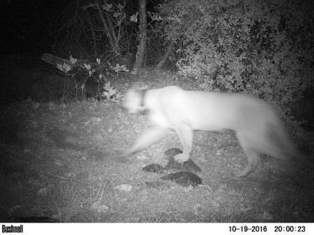
It is also near the area I believe the San Diego River Park Foundation spotted this guy. They say the radio collar is inactive now and that he is one of the last living lions from the UC Davis study. I have this obsession with trail cams lately so seeing this on Facebook piqued my interest big time.
 |
| Photo belongs to San Diego River Park Foundation - Posted on their Facebook October 2016 |
I cruised around slowly just checking stuff out and trying to figure out which peak was which. I also spent a long time looking at Cuyamaca Peak. I didn't take any photos that would do it justice but after a long hard look thru binoculars at the west face I decided you could summit that way if you were looking for an adventure. There appear to be several fire roads winding their way up to the drainage at the base of the peak. There is a sort of headwall that reminds me of Mill Creek Jump Off, albeit with a lot more buckthorn. I think you would be able to find your way up this headwall by following some well defined animal trails. I posted an inquiry to the SD Hiking group's facebook page to see if anyone has done it but I only got a little bit of interest in people doing it in the future, as opposed to someone that had already done it. It's definitely on my bucket list, that's for sure.

I continued on Boulder Creek road just passed Mineral Hill, when I ran into a construction crew who was working on the road. The excavator they were using had support legs that were too wide for me to squeeze my truck around. I turned back the way I came and stopped at a turn out to check out a snake in the road, when I spotted all kinds of yellow signs posted to the trees. They warned of a federal mining claim in the area and forbade anyone from prospecting. I wonder what they have found here? When I got home I googled the area and found out there is a mine on Mineral Hill and after spending waaaaaaaaaaay too long watching youtube videos of local mines, I REALLY missed Josh.
But I digress.
This area also appears to be a less maintained section of the San Diego River Trail. I wanted to head out on that trail and explore, but for some reason I have "the fear" lately, mainly centered around setting out on unmaintained trails in far out locations. I hope that goes away soon. I headed into Cuyamaca and stopped by the lake to look at my massive Cleveland Natl. Forest map and decided to try my luck rejoining Boulder Creek road by heading down Engineer road. I passed thru the Cosmit Indian reservation and then on to the Inaja reservation where I met up with Boulder Creek Road once again and headed south in hopes I could make it all the way thru.


Much to my chagrin, I ran into more excavators and giant water trucks with cranky drivers so I turned around a final time and headed north until I met with Eagle Peak road near Pine Hills Drive. I spun around as if my intuition had taken the wheel and bounced down the dusty path.

I passed two hunters preparing to set out, followed by a U.S. Fish & Game Officer running thru a meadow like a goofball with his dog, which gave me a good smile. I had no idea where I was or where I was going but I knew it was beautiful and so I continued. I finally stopped to pee at a turn out and spotted the signs for Eagle Peak Preserve which I had never heard of. What a cool place!

I stepped to the edge of a deep gorge and watched thru my binoculars as a crow chased a peregrine falcon away from her nest and struggled to keep up with him as he dove deep and fast into the gorge abyss. The canyon walls were insanely steep and I could see evidence of a tall dried waterfall on the north side. I consulted my map and found I was over looking the San Diego River Gorge and the dried falls was Mildred Falls which happens to be the tallest waterfall in San Diego county and dumps into Cedar Creek falls at the base of the gorge.


I have never been to Cedar Creek Falls and never knew there was a trailhead out here, I thought the only one was in Ramona. After traveling across a rather narrow stretch of road, (that made me hold my breath while trying not to look down the sheer drop into the incredibly deep gorge that I could potentially roll in to) I came to the signs for the Saddleback trailhead.


I vow to return to hike every trail this place has to offer, including down to Cedar Creek. What a great place to do a little exposure therapy on my fear.

But today, I still had the fear, this time of that narrow section by the gorge and didn't want to be faced with someone coming down the hold-my-breath section of road while I was trying to go up it so I jumped back in my truck and headed out the way I came. On my way thru the wider sections of road, I spotted a beautiful tarantula and watched him do his thing for a little while.

I merged back with the 79 in Wynola and headed toward Lake Henshaw. I don't know why I'm drawn to this area lately but I get excited when I know I'm close to the barn quilts. I turned in to the Inaja Memorial day use area, seeing as I've passed by it a zillion times and never stopped. It was a quaint little picnic area with a nature trail and I set out on it in the dwindling light.

All of the Our Lord's Candle Yuccas were dried out and I instinctively hit the trunk with my hand as I walked by setting off a loud rattle that could pass for a snake and listened as the seeds showered the ground. The act made a my stomach tighten into a ball and my eyes tear up as I remembered all of the times Josh and I did this with a giggle intending to scare one another, and I desperately missed my friend. I tried to get it together and put my head back in the curious mood I had been in most of the day, but I just felt sad so I headed down to the truck.


It was crepuscular time and I wondered if I could see any animals; maybe Spirit would have something to tell me, so I drove out toward Warner Springs. I saw many hawks and a coyote in the distance but nothing really crossed my path. Even driving thru the Los Coyotes reservation the land was still and quiet. I feel like Spirit isn't talking to me anymore, and that makes me question my path. My mom told me she thinks maybe Spirit isn't talking because there isn't anything new to say, or maybe I'm looking in the same places for different answers that are unable to appear. I think that is a good way of looking at things, like maybe I need to branch out and visit new places in order to find a new direction. So, I've decided, that's what I'm going to focus on from now on.


On to new adventures.
No comments:
Post a Comment