Showing posts with label Cuyamaca Rancho. Show all posts

Friday, November 11, 2016

Japacha Peak Do-Over

The stupid Santa Ana winds are killing me at home. It's been almost 100 degrees at the beach for a couple of days and I can't deal. 
Seriously November. C'mon now.

I have been feeling super bazaar lately, with a lot of visual disturbances that are migraine like but with no pain. I feel generally out of body, and when I'm not blinded by sparkly lights, things look really big or really far away and sometimes I think I'm moving when I'm standing still. I went to the doctor and she didn't seem concerned, so I figure since its been going on for weeks, this is my life now and I need to get used to it. 

I was hoping some exercise would help get me grounded, so I took advantage of the cooler inland temps to get a hike in. I drove without a plan on where I was going and listened to old 90's rock super loud as I drove thru Mount Laguna. 

The only redeeming qualities of the Santa Ana's is that the air gets really clear between brush fires and you can see for a looooong way. 

I have been annoyed at myself for not being able to reach Japacha Peak. I'm tired of being fat and sick and not hiking like I used to. Before I knew it my subconscious took the wheel and I was back at the West Mesa trail head. I got a late start and headed up the fire road around 11am. I was pleasantly surprised at how good I felt, albeit still dizzy, and I made it up the road in record time for me.

I stopped to pee and noticed this cute little birdhouse hanging form a tree! 
In hindsight, I hope its a bird house and not a trail cam because if it is, it totally has pictures of me peeing. -_-

I didn't see as many tracks as I did the last time I was out here and I felt a little bit better about the hike.

But as the fire road turned to trail I kept hearing rustling in the bushes. It would happen while I hiked and stop when I stopped. Some I could attribute to birds and wind but others sounded much larger. I started to get 'the fear' and I thought it might be a good idea to play music on my phone so I could announce my presence to any unsuspecting mountain lions. I normally hate when people play music on the trail for all to hear, but on a Thursday afternoon I didn't think I was going to run into anyone else and bum their trip (even though I secretly hoped I would because I was scared).

I was grateful for the wind as it helped to keep some of the bugs at bay while I trucked thru a damp creek drainage. I was feeling tired but ok and pushed hard to make it to the top. 


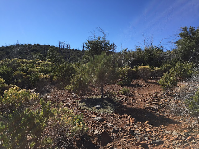
Finally, after several long and winding switchbacks I crested the hill onto a small saddle. Cuyamaca peak came into view and I looked down on the west face that I had viewed from the bottom a few weeks before. You could totally summit from that side. It wouldn't be fun but it would be cool!


I turned my attention to the high point to the south. I knew it was going to be a bushwhack but I didn't realize how bad it would be. I spent a long time looking for some kind of use trail through the buckthorn but to no avail. Even Middle Peak, which is a bushwhack and a half, had a use trail. I got frustrated and just kind of charged into it, all the while cursing myself for wearing capris while my legs were being shredded by the plants. I made it up to a boulder pile but couldn't find solid footing. I looked around for some kind of summit marker or register box but found nothing. There was another slightly higher boulder pile a short ways away but my legs were scratched and itchy and I was just generally over it. 
This is my summit for today, I thought. Close enough, fuck it.

I climbed back down with no particular direction, just trying to find the route with the least possible contact with scratchy plants. When I got back to the saddle I sat on another boulder pile and ate a snack and drank some water. I was smart this time and brought three liters after cameling a fourth in the car and I definitely needed all of it.

It was just before 2pm but the shadows were already starting to get long (curse you time change) so I started my descent. My body was super duper sore and I knew it was going to be a slog but I rode the satisfaction of having made it to my destination, albeit approximately, most of the way down the switchbacks.

As the Burnt Pine trail met with West Mesa, I again started hearing noise in the brush that was too big to be birds. I was nervous so I turned up my music and looked behind me every now and then, scanning the brush for what might be following me. I wanted to know what it was just as much as I didn't, and it made me pick up my pace to an unnatural gait. The trail dropped into the creek drainage and I came across some very large, very fresh mountain lion scat next to tracks that led to the bushes and felt my stomach get tight.

Maybe I'm just being paranoid I told myself. I have been walking with a lot of fear these days since the break up. I keep telling myself it's due to a lack of confidence and self reliance and the only way out is through. I have to keep pushing myself to do the things that make me, Me, and work through the anxiety. After my self pep talk I let out a little woooooo! Which I hoped would be a motivator to myself and a detractor to whatever was watching me in the bushes and I high tailed it out of there.

Finally, the narrow brush lined trail met with the wide fire road and I felt a bit better about my odds. It was here I found a set of  very fresh bobcat tracks weaving in and out of my own and figured that was who was stalking me. 


I had a run in with a bobcat and her two kittens on the Airplane Monument trail a few years ago which isn't far from where I was. Sorry for the potato quality. Phones didn't have great cameras like they do now way back in 2012!


This one you can actually see mom on the top right. On that hike I decided to head back after I saw them because I wasn't sure how crazy mama bobcats will get over their kittens. She ended up stalking me by zigzagging the trail behind me, and in no secret kind of way either. I waited by a tree for a bit with my camera ready to see if I could catch her crossing, when all of a sudden one of the kittens popped out on the trail right by me. I kind of freaked out and stepped away and the kitten let out a little squeak and jumped back in the brush. I was close enough to the road by then that I didn't fear an altercation, but I still walked pretty fast back to my truck!
 But I digress, Back to this hike...

 I was pretty sore by the time I made it back to the truck and my eyes burned something fierce from all of the salt on my brow, but I didn't get eaten, so I had that going for me which was nice.

I drove home tired but satisfied at being one step closer to once again being comfortable in my own skin as a solo hiker.

If anyone has a gps track or directions to find the use trail to the summit register of Japacha please hit me up! I don't know if I'll attempt it again anytime soon but I kind of want to see how close I was to it!


Monday, October 31, 2016

Dirt Roads

I knew Josh and I couldn't go on like this forever and we finally met at the crossroads, inevitably deciding to cut it off completely. 
Feels bad, man. 
After that conversation I had to get out of my apartment and into a wide open space to let the energy disburse. 
I headed out to Anza Borrego and followed a wash toward Font's Point. The view did not disappoint and I spent a long time just sitting in the open trying to let things go. Maybe it's a big mistake on my part, only time will tell. I know no one will love me more than him, but I also know someone will love him more than I'm capable of, and honestly, that is more important to me.
In order for that person to arrive for him, I have to get out of the way.

I pushed thru the week, trying to stay busy at work, and on the eve of my day off I told myself that the next day I would go out for a super long, solo hike. Then, for some unknown reason, I proceeded to spend the next 2 hours sitting in the dark by myself reading a variety of graphic stories on message boards and blogs about local Mountain Lion sightings and attacks.  
While this was not conducive to an enthusiastic solo hike, it did plant a seed in my brain about places that were deemed wildlife corridors. 
The next day with thoughts of cougars dancing in my head I headed east to Descanso. 

After a short drive thru town I headed out on Boulder Creek Road. This dirt road is the way out to many hiking destinations like Three Sisters Falls and Eagle Peak. 

It is also near the area I believe the San Diego River Park Foundation spotted this guy. They say the radio collar is inactive now and that he is one of the last living lions from the UC Davis study. I have this obsession with trail cams lately so seeing this on Facebook piqued my interest big time.
Photo belongs to San Diego River Park Foundation - Posted on their Facebook October 2016

I cruised around slowly just checking stuff out and trying to figure out which peak was which. I also spent a long time looking at Cuyamaca Peak. I didn't take any photos that would do it justice but after a long hard look thru binoculars at the west face I decided you could summit that way if you were looking for an adventure. There appear to be several fire roads winding their way up to the drainage at the base of the peak. There is a sort of headwall that reminds me of Mill Creek Jump Off, albeit with a lot more buckthorn. I think you would be able to find your way up this headwall by following some well defined animal trails. I posted an inquiry to the SD Hiking group's facebook page to see if anyone has done it but I only got a little bit of interest in people doing it in the future, as opposed to someone that had already done it. It's definitely on my bucket list, that's for sure.

I continued on Boulder Creek road just passed Mineral Hill, when I ran into a construction crew who was working on the road. The excavator they were using had support legs that were too wide for me to squeeze my truck around.  I turned back the way I came and stopped at a turn out to check out a snake in the road, when I spotted all kinds of yellow signs posted to the trees. They warned of a federal mining claim in the area and forbade anyone from prospecting. I wonder what they have found here? When I got home I googled the area and found out there is a mine on Mineral Hill and after spending waaaaaaaaaaay too long watching youtube videos of local mines, I REALLY missed Josh.
But I digress.
This area also appears to be a less maintained section of the San Diego River Trail. I wanted to head out on that trail and explore, but for some reason I have "the fear" lately, mainly centered around setting out on unmaintained trails in far out locations. I hope that goes away soon. I headed into Cuyamaca and stopped by the lake to look at my massive Cleveland Natl. Forest map and decided to try my luck rejoining Boulder Creek road by heading down Engineer road. I passed thru the Cosmit Indian reservation and then on to the Inaja reservation where I met up with Boulder Creek Road once again and headed south in hopes I could make it all the way thru.


Much to my chagrin, I ran into more excavators and giant water trucks with cranky drivers so I turned around a final time and headed north until I met with Eagle Peak road near Pine Hills Drive. I spun around as if my intuition had taken the wheel and bounced down the dusty path.

 I passed two hunters preparing to set out, followed by a U.S. Fish & Game Officer running thru a meadow like a goofball with his dog, which gave me a good smile. I had no idea where I was or where I was going but I knew it was beautiful and so I continued. I finally stopped to pee at a turn out and spotted the signs for Eagle Peak Preserve which I had never heard of. What a cool place! 

I stepped to the edge of a deep gorge and watched thru my binoculars as a crow chased a peregrine falcon away from her nest and struggled to keep up with him as he dove deep and fast into the gorge abyss. The canyon walls were insanely steep and I could see evidence of a tall dried waterfall on the north side. I consulted my map and found I was over looking the San Diego River Gorge and the dried falls was Mildred Falls which happens to be the tallest waterfall in San Diego county and dumps into Cedar Creek falls at the base of the gorge. 


I have never been to Cedar Creek Falls and never knew there was a trailhead out here, I thought the only one was in Ramona. After traveling across a rather narrow stretch of road, (that made me hold my breath while trying not to look down the sheer drop into the incredibly deep gorge that I could potentially roll in to) I came to the signs for the Saddleback trailhead. 


I vow to return to hike every trail this place has to offer, including down to Cedar Creek. What a great place to do a little exposure therapy on my fear. 

But today, I still had the fear, this time of that narrow section by the gorge and didn't want to be faced with someone coming down the hold-my-breath section of road while I was trying to go up it so I jumped back in my truck and headed out the way I came. On my way thru the wider sections of road, I spotted a beautiful tarantula and watched him do his thing for a little while.

I merged back with the 79 in Wynola and headed toward Lake Henshaw. I don't know why I'm drawn to this area lately but I get excited when I know I'm close to the barn quilts. I turned in to the Inaja Memorial day use area, seeing as I've passed by it a zillion times and never stopped. It was a quaint little picnic area with a nature trail and I set out on it in the dwindling light. 

All of the Our Lord's Candle Yuccas were dried out and I instinctively hit the trunk with my hand as I walked by setting off a loud rattle that could pass for a snake and listened as the seeds showered the ground. The act made a my stomach tighten into a ball and my eyes tear up as I remembered all of the times Josh and I did this with a giggle intending to scare one another, and I desperately missed my friend. I tried to get it together and put my head back in the curious mood I had been in most of the day, but I just felt sad so I headed down to the truck.


It was crepuscular time and I wondered if I could see any animals; maybe Spirit would have something to tell me, so I drove out toward Warner Springs. I saw many hawks and a coyote in the distance but nothing really crossed my path. Even driving thru the Los Coyotes reservation the land was still and quiet. I feel like Spirit isn't talking to me anymore, and that makes me question my path. My mom told me she thinks maybe Spirit isn't talking because there isn't anything new to say, or maybe I'm looking in the same places for different answers that are unable to appear. I think that is a good way of looking at things, like maybe I need to branch out and visit new places in order to find a new direction. So, I've decided, that's what I'm going to focus on from now on.


On to new adventures.


Saturday, October 15, 2016

A Teaspoon of Water - West Mesa, Cuyamaca

Once we accept our limits, we go beyond them. - Albert Einstein

After doing a lot of reading and soul searching about the medicine prescribed to me to treat this Psoriatic Arthritis bullshit I apparently have now, I've been working on trying to heal my body thru natural channels instead. Not only is the medicine insanely expensive, it is a weekly self injection that can cause a couple different types of cancer, which I'm not super stoked on having. Really, I'm just scared all the way around so if I can't manage it on my own, I will take the meds because being in pain is a bummer, but I kind of want to exhaust all my alternatives before going that route.

Seeing as few things are as beautiful as Cuyamaca in fall, I decided to head out and see if my recent drop in weight and my diligence in stretching, icing and eating a more autoimmune friendly diet have helped. 

I arrived in Cuyamaca round 9am without a solid plan or destination. I cruised hwy 79 and was compelled to stop at the East Mesa turn out. I had tried to hike up the West Mesa fire road a while back and my feet were in such pain I hardly made it a quarter mile. What better test of my healing than to try it again. 

I passed thru a pipe gate and immediately saw dozens of tracks in the powdery sand:


I think this one is a lizard.

Perhaps a Crow or Hawk? Seemed to big to be a Jay or Dove but not big enough to be a Turkey.

Beats me!

I'd say this bird is likely no more.

A lizard and a rodent with a bobcat in between.

A big bobcat or a small cougar?


Hard to tell in the soft sand if its feline or canine.

There is a lot going on in this one. The top left looks like a skunk then there is a small rodent trail going diagonally with a bobcat track at the end like he pounced on the rodent.

A deer? I can't figure this one out!

No Idea...

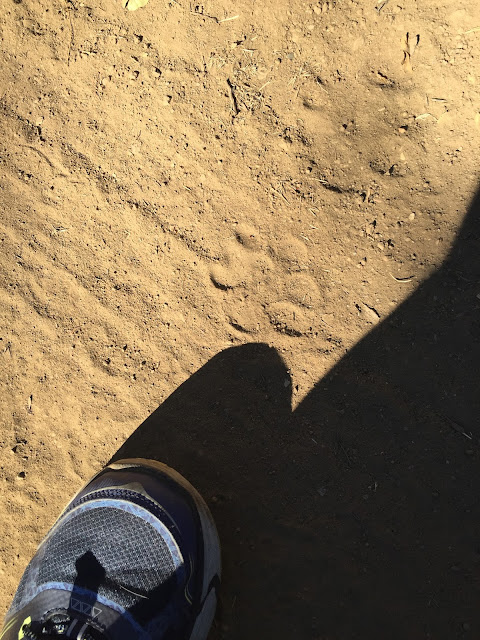
And....Here's where I met up with the Cougar tracks. There were at least 3 sets I counted. Not sure if it was the same guy coming and going but this is from the freshest set which was going in the opposite direction of me. 

I wear a women's size 10. I have big feet. This is a big Cougar!

I made my way up the road slowly and was passed by a vehicle who, through not fault of his own, covered me in dust but I didn't care. I was too busy reveling in the fact that my feet didn't hurt! The road climbed gently but steadily and Stonewall Peak became visible in the distance. 
It was a beautiful day!


After a little over half a mile I came to a crossroads between the Japacha/West Mesa fire road and the junction to Fern Flat fire road. I decided to follow my Cougar buddy's tracks and rounded onto toward Fern Flat. The road leveled out for a stretch and then climbed over a small hill. 


After the hill, the road started to head down which was nice but I was feeling a bit skittish with all of the Cougar tracks and impressions in the grass. This cat was not small. Here you can see his tracks in comparison to horse tracks and a large pair of men's boots. 


I kept my senses tuned into the surroundings and enjoyed the colorful leaves of the black oaks which have started to turn. The leaves fluttered off the tree in the breeze and crunched under my shoes.

In the distance I could see the East Mesa grasslands shimmering in the sunshine before a backdrop of fog.

 I rounded a bend and it was easy to see why the cougar lived on this road. The grass was tall and yellow and there were dozens of shady grottos in which to rest and hide.

Trying to spot any cat out here would be an exercise in futility. I tried to not freak myself out, but the whole time I was in this area I could feel something watching me. 

Stonewall was looking particularly lovely with her granite crown shining in the sun.


I reached another junction and decided to divert from the wide road and try my feet on a narrow trail, so I headed up the West Mesa trail toward Japacha Peak.


The terrain was dry and lackluster and the birds kept me on my toes as they rustled in the brush. At any moment I expected to meet my cougar friend but all I was met with were bugs.

After the fourth gnat/fly thingy flew up my nose I went for my head net. I am so glad I brought it with me! The trail wound its way thru the Japacha Creek drainage making the trail soft and marshy with a gazillion little bugs.

  
I walked along a ridge for a while and the day was heating up. The weather was only supposed to top out at 70 but my thermometer read 80. I stopped for some water and realized I had only brought a little over one litter, which was more than halfway gone. I thought I had an extra bottle in my pack from my last trip out but was disappointed.


I sat at the junction for the Burnt Pine Trail for a while trying to figure out what I wanted to do. I was feeling so good and had developed a bit of summit fever as I went, wanting to finally bag Japacha Peak. I looked at the map and convinced myself it wasn't too far and I could just ration my water. Great idea!


I headed up the Burnt Pine trail away from the ridgeline and followed a set of switchbacks that wound in and out of tiny pine grottos. I kept my eye on Japacha Peak and felt like I could reach out and touch it, but with every switchback it looked further and further away.

The day was really hot now and I sat in the shade to think. I was really thirsty and only had about a cup of water left. I decided I had to call it and turned back down the switchbacks toward the West Mesa trail.

 Things stopped being fun on the way back as I was hot and thirsty but my feet didn't hurt, only ached in a manageable sort of way and that made things easier. 
I'll get you next time Japacha! 
Just wait!

I arrived at my truck with a teaspoon of liquid in my bottle and a major headache, to find I only had a couple sips of super hot water in my nalgene in the front seat. I made a beeline to the Cuyamaca Lake Store and bought some exorbitantly priced, but ice cold water and a can of cold 7up before taking the long way home. 
I guess I'm out of practice! It is not like me to not bring enough water!

This is my 'I think I might barf' face - which I'm sure you're all familiar with by now.

When all was said and done I did a little over 6 miles and about 1200 feet in elevation gain. Certainly not amazing stats as hikes go but they are for me! This is the furthest I have hiked since I've been sick and I am feeling very hopeful that I'm turning toward bigger adventures in the future.