Showing posts with label Psoriatic Arthritis. Show all posts

Saturday, February 11, 2017

Morena Butte

When I left the house to hike I wasn't really sure where I was going. I headed east on I-8 and made a pit stop for gas and hiking snacks at the Cheveron on Alpine Blvd., as I always do, and there it hit me: lets go do Morena Butte! I felt kind of excited to go see my friend, the PCT. I've been thinking about the trail A LOT the past few weeks so it would be nice to finally be back on. When I arrived the day was beautiful and I parked on the side of the road just outside of Morena Lake Campground property.

It was kind of weird to be going south on this section. I have done it so many times I know it like the back of my hand but heading in the opposite direction gave it a new novelty. I kind of huffed and puffed heading uphill and used the information markers as an excuse to catch my breath. Lake Morena used to fill this reservoir but The City of San Diego decided to divert the water to Otay Lakes leaving Morena mostly meadow.

After more uphill my destination came into view, Morena Butte the a red hued beast loomed in the distance. No matter which direction you come from it is the mark of hard hiking. When it comes into view from the other side your heart kind of drops knowing you're going to have to drop down to its base and then climb out after having done 15 miles and still having more to go.

As the trail climbed higher I was able to see a bit of water in the reservoirs from all the rain we've had this season. The class of 2017 is in for a real treat in the desert this year, as all the tributaries are flowing and there is water running right thru the trail in this section that is notoriously dry.

The recent rains also left a record of the local residents, and I stopped to check out cougar, bobcat and deer tracks in the mud. After following the cougar tracks for a ways I came across a good sized pile of cougar scat that I promptly poked at with a stick.


The trail came to an odd junction that I'm still not sure about. I consulted my map but it wasn't any help so I decided to keep going on the PCT as opposed to investigating this other side trail. One day I'll come back and check it all out.

Soon the trail turned into a creek bed and it made me think of the Class of 2017 and how much water they're going to have to deal with this year. Here in SoCal I think it will be wonderful but the Sierra is going to be nuts.

I dropped into a dry creek bed just before the pass leading into Hauser Canyon. There was another trail junction here which I think goes to the dam.


At the top of the pass I sat on a boulder that Josh and I had sat on many times before both on day hikes and on our section hike and I reminisced about the PCT. My musings were interrupted by a rustle in the bushes next to me and I was startled to see a man pop out of the brush. He was dressed all in black and told me he had seen me come down the ridge. I laughed and told him I hadn't seen him at all and that he scared the shit out of me! He smiled and told me his hiking partner has done that to him once or twice out here and it was then that I noticed he was with the Border Patrol. We chatted for a while about the PCT and Morena Butte and he told me he was setting up trail cams at various points along the border. He explained that sometimes animals trigger the alarms and it takes a lot of resources for agents to investigate, so with the cameras they can check remotely to see if it was a human or an animal that tripped the sensor. He was a very nice guy and his enthusiasm for his job was contagious and when we parted ways I was feeling pumped about climbing this butte! 

That is, until I started climbing and found it was so steep I had to use my hands in some places! Holy shit! I did my standard hike 5 steps and rest pace until the trail ran out of hillside temporarily.


I walked a small ridge line below my next challenge and it reminded me of North Fortuna. Already the views were amazing and on such a clear day I could see for a long way into Mexico.

As I neared my next climb the brush got denser and the granite more abrasive and I smacked my elbow on a boulder. Since my elbows are broke out with psoriasis right now it exploded and bleed everywhere. I had this happen on another trail recently and I am always glad to be out there by myself so no one will see what looks worse than it really is!

Soon the trail dissolved and I was navigating completely by cairns. I climbed and climbed and eventually found myself heading toward the backside of the butte.

After making my way to a narrow plateau I came across this cave that is undoubtedly home to a cougar. This is just the patio portion of the cave, the rest of it went deep inside the boulder structure. Normally this would cause me to feel afraid but I didn't. I don't know if it was being back on the PCT but I felt surprisingly calm and happy on this whole hike. Maybe I'm making progress!


Not far from the cougar cave was a convenient water source. I dodged slick collections of algae as I continued up the hill.

The brush gave way to large granite slabs making the cairns more difficult to spot. I consulted my gps for my location in relationship to the highest point and found I had passed it on the back side.

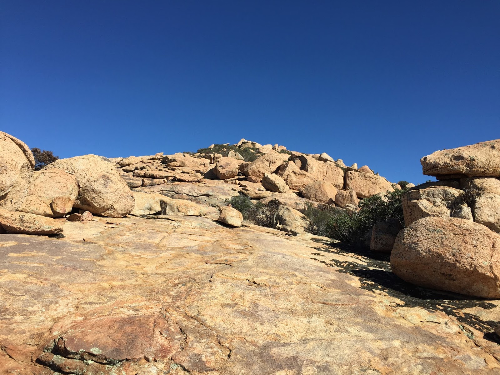
Finally, I just blew right up a large boulder field with a 'lets get this shit done' mentality and popped out on the top of the butte with 360 degree views of awesomeness. 
I spotted a high boulder and ascended it rather ungracefully, again feeling grateful I was the only one up there to see me. I found a register inside an old first aid kit  that was wedged in a crack in the rock. The register was just a 1/3 of a pocket sized memo book but there was enough room for me to sign. Josh told me later that he was going to climb up here so I told him to bring another book, and he did, so there is something for you to sign should you decided to climb it too.


While meandering around the summit looking for benchmarks I stumbled upon this feature in the rock. I touched the edge and it seemed to be set inside. I was wondering if it was a fossil and emailed it to the archaeologist I met while on Ghost Mountain. She is going to forward it to a paleontologist but another friend of mine said it was probably just an old mud dauber nest. Either way it's kind of neat looking!

I ate some lunch and considered hiking to the other high points but I was near the end of my water. I decided to save them for another day when I explore those other trails, the dam and maybe ascend from the other side.

The boulders up here gave me high Sierra vibes even though the granite was different. I love this bizarre landscape.

I also noticed large crystallized chunks of quartz in the soil covered sections. The quartz was beautiful and sparkly having just been cleaned by the rain.


On my way back down to the PCT I met a pair of Ravens who looked at me curiously. I gave them a couple of clicking noises and they responded with some enthusiastic head nods.


As I arrived back on the PCT I met the first thru hiker of the season resting on the side of the trail. I thought he might be a southbounder but he said he was northbound and just getting an early start so he could take his time. We chatted for a bit and he gave me two trail names, both of which I have now forgotten. (I have to write this shit down!) I headed on before him and told him I was sure we'd meet again, and we did as I was taking a break on a boulder. I looked down inside a crack and saw what I thought was a mandible. I was fiddling with my phone to take a photo of it when the Nobo arrived. "You don't have serivce out here do you?" he asked. I told him no, that I was just taking a photo and reached in to get the bones to show him. When I pulled it out I realized it was an intact skull of a squirrel. I told him I always find dead shit on my hikes and he said that was a good thing because it means there is live shit out here too. I like that. It kind of gave me a different perspective and something to think about for the rest of my hike.


I played tag with the Nobo for a while, finally leaving him to his thru just before the end of the trail. I headed out of Morena on my way home and stopped at the rest stop between the freeway off of boulder oaks road. When I arrived, the parking lot was relatively empty and I pulled into a random parking space to find a dime right next to my truck. I love finding dimes in weird places like this because my mom always said when you find a dime it's God's way of telling you you're on the right path. I feel like I'm on the right path again. It feels good.

All together it says I did 9.17 miles. That's a new record for me since the arthritis! I'm getting my legs back! Yay!

Saturday, December 24, 2016

Lost and Found In Joshua Tree

The Geminid meteor shower was peaking and since I haven't been on an overnight trip in a while I decided to keep with my desert theme and book a couple of nights in Joshua Tree. The drive out there was filled with memories ranging from being a kid blasting techno and doing 100mph thru the badlands, to limping under the I-10 overpass barefoot on my way to Ziggy and The Bear's. With all of the memories from growing up here, it is hard for me to see this area as a tourist, so I thought I might stop at the visitor's center and pick up a guide book to hopefully see something new. 

I arrived at the west entrance visitor's center around 10am and awkwardly stepped inside. It was busy and I was feeling out of place for no other reason than free flowing anxiety. I managed to make it to the book section and crack open a few to see what they might be about. I was distracted by the people around me and couldn't focus long enough to figure out whether the books I was looking at were what I wanted, but one stood out due to the beautiful photography so I decided it was the one.

After leaving the visitor's center I took a slow drive thru the park and was kind of blown away at how beautiful everything was. I guess maybe I have been away long enough to have fresh eyes. As I neared the turn off for Geology Tour Road I remembered last time I was here I had the Nissan which was 2wd and I was cautious about taking it very far, but not this time! Now I have my tough 4x4 V8 4runner with some new bilsteins and A/T tires to break in so I zipped on down the washboard road to see what I could see.

I stupidly forgot to get the tour pamphlet so I just kind of ogled the rock formations like a dork. Just passed where the road turns to a one-way I came to some remnants of the Hexahedrone Mine. There was a car parked at the trail head and I wondered where they were and what they were seeing out there. 

I hopped back into the truck and continued on thru the loop. I came to the junction for Berdoo Canyon road which was originally used to get to Berdoo camp where workers lived while building the Colorado aqueduct in the late 20's early 30's. It is now a popular 4x4 road with locals and even my mom tells a story about cruising around Desert Hot Springs as a kid in her boyfriends Jeep. She says they crawled around for a long time having no idea where they were and watching as the terrain changed from creosote to pinion pine until they finally popped out on hwy 62. It was only then that they realized they had discovered Berdoo Canyon Road. I want to do this one day, but today, I have other things to see.  


I continued on thru the park and headed out the north entrance down to 29 Palms and on to Indian Cove campground. I love this camp and the way the spots are situated in the rocks because it seems to cancel out any noise from your fellow campers. This particular space was awesome as it was tucked away by itself in a nice cove and faced the direction of the meteor shower. It felt like home and I was super happy to be car camping for the first time in a long time.

I set up camp and tried to get a fire going but was having a hard time getting it started with minimal kindling. I remembered something that Josh had said a long time ago about using Vaseline as a fire starter. I wondered if it would work, I mean, it is just petroleum after all so why wouldn't it, right? I covered a paper towel in chapstick and tucked it under my little log tipi and lit the edge...

 ...Viola! It worked! Thanks Josh! As I got my dinner of hot dogs and stale tortilla assembled (not the best meal plan) I thought of Josh and wondered what he was doing. I fought the urge to text him, like I do most nights. I miss him.

The day dropped into night and I sat by the fire for a long time. Even with the moon as big and as bright as she was I still saw about 10 turquoise colored meteors skip across the sky over the course of the night and each time they would make me smile. I pulled out the book I bought at the visitors center and read it by headlamp. It is called Joshua Tree National Park, The Insider's Guide By Robert Miramontes. I read about the Desert Queen Mine and having hiked to Pine City in the past I was semi-familiar with the area so I decided it would be a good hike to start the day with.

I spent a long time just sitting and trying to be in the moment, which is hard for me because my brain loves to ruminate on shit. I looked at my truck sitting all tough in the moonlight next to my little camp and I reminisced. I thought about being a teenager camping at Jumbo Rocks and getting loaded with a bunch of friends. I remembered how I longed to be alone there, especially after getting puked on by my very drunk friend. Flash forward to tonight and here I am now, doing what I wanted to do then, and I decided teenager-me would have thought adult-me was pretty cool. I think that's kind of a neat thought. Sure, teenager-me was an idiot most of the time but adult-me isn't that bright either and at least I was genuinely 'me' back then. The positive opinion of a genuine version of myself is a good thing, no? I finally decided present-me was too loaded and too cold to continue this thought session as the fire turned to ember and I retired to my truck for bed. Each time I woke to turn over, which was frequently, I spotted another meteor streak across the sky and felt happy.

The next morning I sat in my truck, dazed and aching from the shitty nights sleep I'd had. The 4runner has many advantages over my past trucks but sleeping accommodations is not one of them. I drank some coffee and looked around at the rocks, spotting faces of cosmic ancestors frozen in the monzonite. 

I dressed and packed up the stuff I didn't want stolen and headed out. I turned down Queen Valley Road and parked at an already crowded trial head. As I was prepping my gear an older gentlemen asked about the distance to the mine. I showed him the guide book and we chatted for a while. He was a bit eccentric, which I like, and he talked about how much he wanted to pan the tailing of the mines out here but that he would refrain since it is a national park. He headed on before me and I told him I'd see him out there.

I re-read the write up in the guide book, trying to commit all the information to memory. Eventually, I laughed to myself, who am I kidding? My memory sucks! I took a picture of the page to bring with me and headed out.

I had only taken a few steps away from my truck and spotted copious amounts of footprints leading down a wash. I followed them and bushwhacked across a rocky slope dropping down to find remnants of a structure, now inhabited by a giant bush, and several artifacts.


I continued on cross country and met with my eccentric gold fevered friend in a large wash below the mine pits. "Oh I wish I'd brought my pans with me!" he said giddy like a little kid as we inspected the large tailings pile spilling down the mountain.

We climbed together up a rocky hill inspecting several open prospecting shafts before rounding a bend to find some old machinery.


It was here that he surrendered to the steep incline and we parted ways. I continued up to the top of the ridge where there were several caged off pits that looked to have been very deep and fruitful.


While investigating some exhaust shafts I found a bunch of burned stick-like things which I think are called punks. Its my understanding that these were used to light the fuses that would ignite the explosives when excavating new tunnels.


After I reached the end of the mine I was still hike-hungry. I climbed around on the hill tops and checked out other tiny tailing piles before heading back to see what else I could get myself into.

I took the regular route out and stopped by an old cabin and a couple of tanks that were discussed in the book.


While reading the plaque at the end of the mine I smiled thinking about a story in the guide book that told of two owner's of the mine and how they wanted to keep it a secret but one of them kept prancing around town in a flashy get-up thereby blowing the lid off their secret.

The day was heating up and I plopped back down in my truck to eat some lunch and see what I should do next. As I was flipping thru the pages I realized I could have continued on down the trail passed the Desert Queen Mine to visit a REALLY cool cabin at the Eagle Cliff Mine. Damnit! I thought about going back out but it was warm out on the ridge so I decided to wait for it to cool off and run some errands. I couldn't sleep like shit again tonight so I headed into town to buy an air mattress. 
On my way back into the Park I decided to hit up Samuelson's Rocks which is something I had never heard of. The book said it is a big secret among the locals and I thought, I'm a local! I should know about this!
The directions to the spot are pretty subjective and vague unless you're actually standing there. In fact, all the directions are this way. It is definitely a book you need to refer back to as you're hiking. I parked on the side of the road and took a picture of the description before heading off across the open desert. 

With my compass in hand I headed on a south/southwest bearing and looked for geographic markers it discusses in the book. I ended up just following a wash west for a long time and eventually found several footprints. One set of prints in particular looked fresh and familiar with a waffle print that reminded me of Pillsbury's tracks while on the PCT. I read and re-read the description and looked for a hill made of rocks amidst a valley of hills made of rocks.

Eventually the directions made sense and I met with an old wrought iron fence that I followed to the base of the hill and viola! There it was!

I hiked around the hill looking for more of his tablets and trying to decipher what they meant. The cliff notes version of Samuelson's story is that he was an immigrant from Sweden who traveled to the desert for work during the depression. Bill Keys gave him a job at one of his mines and he homesteaded near Quail Spring with is wife. Samuelson was a bit out there and you can tell by the things he carved into the rocks. I found a good history of Samuelson here if you're interested in further reading about him. It is pretty interesting stuff!


There was a little iron saguaro on top of this rock that I thought was pretty cute. Later I saw on Instagram that Anish Anderson found one on top of Pinto Mountain while she was doing the Sierra Club's Desert Peak Section. 


After a good tour of the area I headed back in the general direction I had come. 

I lost my footprints relatively quickly and wasn't sure exactly where I was going to pop out when I met the road so I was really happy to see my truck.

I was stoked I had made it to my destination and felt like my guide book gave a sort of treasure hunt vibe in its descriptions. I had read about a place called Iron Door which was a little cave tucked in some rocks that had, you guessed it, and iron door. The only Iron Door I'd ever been to out here was in the desert toward Mecca so I was curious about this one. I made the turn toward Intersection Rock and parked in the day use lot. Following the directions in the book I headed out passing rock climbers as they got stoned on every peak (no pun intended but funny none the less. Getting high would be appropriate too!) The directions read kind of like this: "Follow the wash around as it turns north and as it chokes down several times by boulders. Once you reach the end climb through a set of chalk covered boulders then climb up a wall and go left at the wave shaped rock, turn around and its there." Sounds simple enough, right, well, not really. There are at least three canyons that fit the description and I was running out of daylight. The wind was picking up and the sun dropping in the sky so I called it and jammed back toward Indian Cove to get a fire going before it was too dark. I caught the most awesome sunset on the way and the world looked like it was inside an orange balloon.

 It was pretty dark when I got into camp but everything set up quickly and I looked forward to sleeping better tonight than the night before. I sat by the fire for a while and finalized my plans to finish up the two hikes I'd botched and then jumped back in the truck for bed.

I woke around 4am with bad arthritis pain in my hip and looked out the window hoping for the sun but it didn't show any signs of rising. I looked at a constellation app I have on my phone to see where the sun was and I willed it to break the horizon.

 I eventually fell back asleep for a bit and woke to the sky glowing in shades of pink. Finally!

I got out of the truck and walked around a bit to unfreeze my hip and get it back in alignment. I started to pack up for the last time while watching the sky do all sorts of magical things.

 I pulled out of camp around 6:30 and the day was cold and windy. It looked as if a storm was blowing in and I knew time was of the essence before the wind got out of hand. I had two places to conquer before I headed home. I turned back down Desert Queen Mine road and was the only one at the trail head. The wind made things feel eerie as I hiked passed the mine I'd visited the day before.

I followed the directions in the book which were much like all the other hikes, they only really make sense when you're standing there and even then it's possible to fit what you're seeing into the narrative and get turned around. I reassured myself that I was on the right path by the footprints in the sand and was comforted by the Pillsbury style waffle prints I had seen on the way to Samuelson's rocks. It seems this person was just ahead of me this weekend and I'm glad to have had his fresh tracks to follow.

I climbed and climbed up this rugged use trail and over rocky passes until cresting the top of a remote box canyon. Just when I was sure I was lost I arrived at this tunnel on the cliff side. My spirits rejuvenated I pressed on looking for the Eagle Cliff Mine cabin.


After a few wrong turns I came to a beautiful high valley with oaks and pinyon pines. I passed one last mine shaft and spotted the cabin built into the rocks. NEATO! I exclaimed and waddled my sore hip over to the entrance.


I stood at the door way for a bit and hollered just in case there were critters inside.

Here's a video walk thru of the cabin. You'd think something old and remote like this would feel kind of eerie but I honestly wanted to move in. It felt warm and cozy inside and the presence of the undisturbed artifacts really made it feel like a home not just a relic.


The weather was deteriorating rapidly so I headed back the way I came. I got kind of cliffed-out after a wrong turn while dropping back down into the box canyon. In my attempt to get back to the trail took a sharp yucca leaf to the elbow and since I have a good sized psoriasis breakout there it wouldn't stop bleeding. After failed attempts to contain it I just let it run down my arm and I was glad the trail was empty since it looked much worse than it really was.

I made it back to my truck and cleaned up my arm before following the dirt road out to Hidden Valley.

I grabbed my compass and guide book and followed the wash below Intersection Rock once again, in search of iron door.


 I tried my darnedest to find the right area but alas I was stumped. I asked a couple of rock climbers if they could point me in the right direction. "Sure!" he says, "see that rock there? Go passed it to a narrow hallway, shimmy thru that and over a rock wall, then make a right at the cactus, climb over the round boulder and duck under the wave shaped rock and it's there! Can't miss it! If you can't find it though, we'll be right here, come find us." I thanked him and was all warm and fuzzy inside for how nice they were! While the directions sound ridiculous without seeing the corresponding landmarks, they were actually awesome and I went right to it!

It is located in a much smaller rock pile than I expected, not in a canyon at all! No one is really sure why this is here but one of the legends says a miner built it to lock away his brother when he was getting on his nerves. It looks to me like it was more likely storage for explosives or other mining supplies.


I waved goodbye to the climbers on my way out and was floating on a cloud of accomplishment having seen all of the things I set out to see! I jumped back in the truck and watched as a couple of climbers interacted with a roadrunner before pulling out and heading down the mountain toward home.

The storm was in full effect and I ogled San J and San G as cloud hats formed on their peaks. It was a really, really good trip and I feel like it kind of sorted stuff out inside me.

I'm looking forward to whatever is around the next bend.


Here's an amazon link to the book if you want to buy it. I don't have any stake in the book or anything, I just thought it was cool.