For hike 2 of 52 I chose to hit Eagle Peak, which is a hike I had attempted back in November. It was so hot that day with thermals radiating out of the canyon that I opted to turn around less than a mile in. Today, however, the weather was perfect for a shadeless climb in the Cleveland National Forest. I took a soggy I-8 east passed El Cajon Mountain cloaked in mist before exiting Hwy 79 and making a left toward Descanso.

I made another left on Viejas Grade just after the tiny downtown area and a right onto Oak Grove Ln. From here I followed Oak Grove until it met with Boulder Creek Road and took that beyond the pavement's end to the hairpin turn that is the beginning of the hike to Three Sisters Falls.

I was amazed to find I was the only one at the usually crowded trailhead, especially after such wet weather. I packed up my gear and tinkered with my new Delorme Inreach before setting out on the trail.

I had just started down the old service road looking at scat and tracks in the mud when I looked up to find there was already two cars parked next to me. In a way it made me feel better, knowing I wasn't out here on my own, considering the trail to Eagle Peak is not an official trail nor is it maintained.

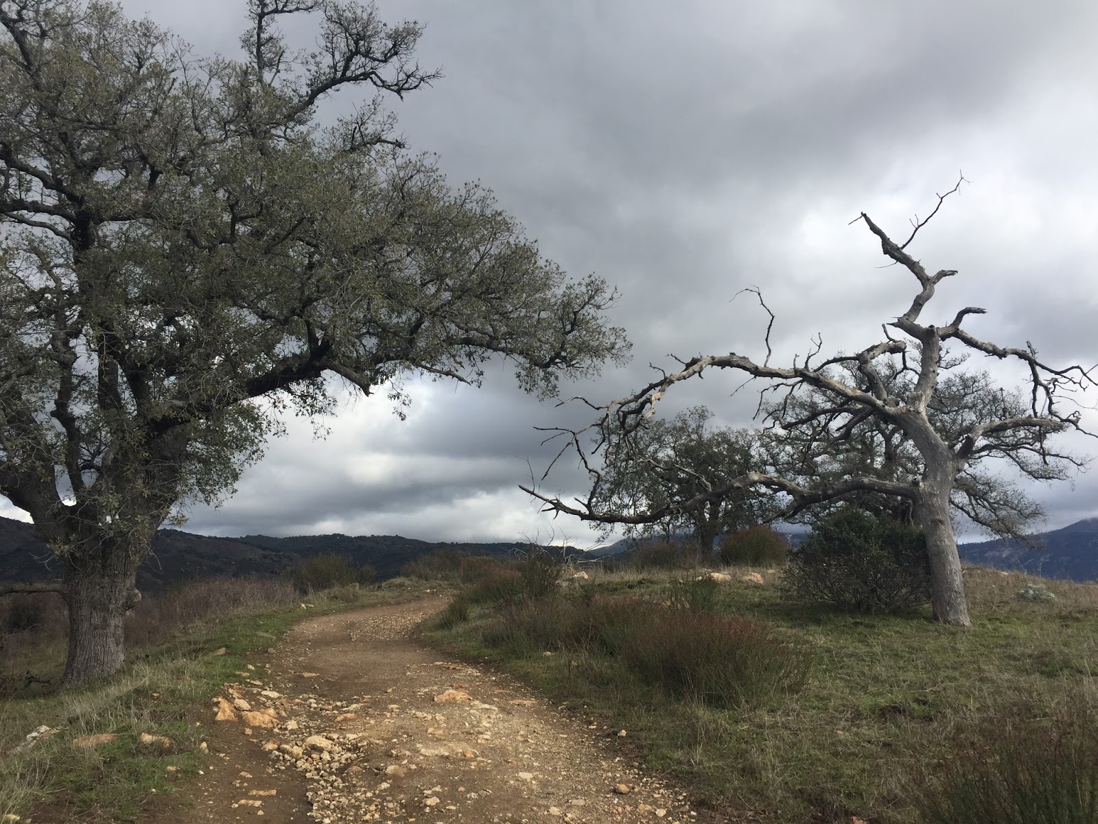
The junction to Three Sisters is haphazardly marked on a small saddle and I reached it in no time. Instead of making a left into the steep canyon toward the falls, I headed straight on an overgrown but easily negotiated trail that hugs the crest of a small hill.

I stopped briefly to take a drink of water and a pair of girls came up behind me. I was kind of surprised to see them and asked if they were heading for the peak too. They looked at me confused and said they were trying to get to the falls. I gave them directions and made sure they had enough water and food before we parted ways. I did Three Sisters a few years ago and it was tough! I was probably as fat as I am now and really struggling with nutrition and low blood sugar. I bonked so hard I didn't think I was going to make it out, not to mention barfing the whole way home.
I am always worried about people who go down there and probably come off like an asshole when asking them if they have enough food and water but many people and pets HAVE DIED down there, so I'm ok with being an asshole if it means they will think twice about their gear.
But I digress...

The trail leaves the crest of the hill and enters a chaparral filled canyon which I've named Cougar Corridor. I could feel eyes watching me and there was some pretty fresh scat about. I made as much noise as I could so as not to startle any unsuspecting animals.

The wide trail soon narrowed and began to climb the mountain in a no-bullshit trajectory. I leaned in to the steep incline and pushed my way up and over muddy rocks and roots. I stopped to catch my breath and looked down to see a large tick climbing up my pant leg. I did the freak-out-get the fuck off me-hokey pokey dance and spent the rest of the hike paranoid about ticks. Anxiety mind is always exciting as it plays scary events over and over and over and over...

After a steep and meandering climb I came to a Y in the trail. To the left there was a small rock cairn and to the right a well worn path. I forced myself to follow the cairn since I've been really good at not following directions lately.

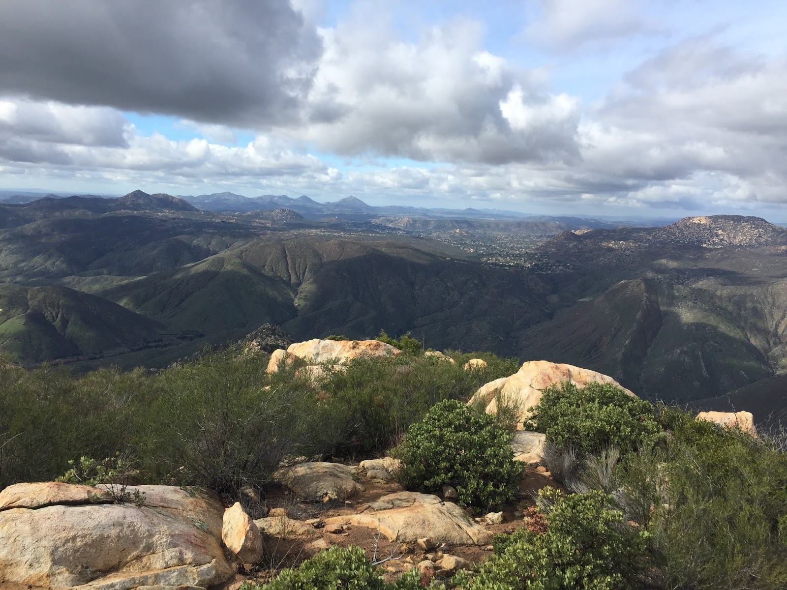
After a short but steep climb I arrived at a small saddle between two high points. I looked to the right and saw the summit and realized this was not the route to the summit. The amazing view into the San Diego River took the sting out of the effort it took to take the detour, and although I wish I'd have hit the view on the way out as opposed to the way in, I was happy I checked it out.

I went back the way I came and took the unmarked junction back up the mountain. It was getting steeper now, and the rocks bigger and the going was as slow as the views long.

I was almost to the summit and gave it all I had to make it to the top

Only to discover the trail rolled right by toward another, larger summit. Challenge accepted.

I climbed some more, negotiating larger and larger boulders only to find...another false summit!

Well, that one doesn't look to far, I got this! And up, up, up I went. Still feeling good on this beautiful day!

I was lucky to have really good service on this hike and text my dad to follow along with me using the MapShare website with my Delorme Inreach. He text me back that he could see my route and that I was in the middle of nowhere! I sent him this photo showing the parking area where I had begun my journey.

Looking back at the steep trail I had climbed, I knew I had to be getting close to the top... I was nearly out of mountain!

And finally, I did! I made it to the top! I grabbed a seat on a large boulder next to the survey marker and took in the amazing views. I was stoked to finally have hit a peak that had a summit register I could read and sign! Silly the little things that make you happy.


Here's some more pano action

And a view of Mount Woodson

My dad FaceTimed me at the top, having seen that I arrived thru the MapShare site, and it was really fun to show him the views.
After a snack and some water I started the steep descent back.

Upon my return to Cougar Corridor I met a couple heading down the canyon. I figured they were lost looking for the falls and asked them if they were heading toward the peak. They too looked at me confused and asked if this was the way to the Devil's Punchbowl and Cedar Creek Falls. I returned their confused looks and told them Devil's Punchbowl is on private property up the creek from Three Sisters. They told me they didn't have a map but that someone at the trailhead told them they could go this way to Cedar Creek and it was only 5 or 6 miles. I looked at my map and saw that it could, in theory, be possible, but that it would be a bushwhack and at least 5 or 6 miles one way. It was already late afternoon so I successfully talked them into going down to Three Sisters as opposed to a cross country jaunt to Cedar Creek.

I passed them on the way back toward the trail junction and told them I was slow and to pass me when they caught up but I beat them to the saddle. When they arrived at the junction the girl says, "you're not slow! you're a fast hiker!" I laughed and told them I was so out of shape that it felt good to be told I maybe still had my legs, even just a little! We parted ways and they headed down to the falls and I headed up the hill that I've nick named 'the final fuck you' toward the parking area.
I passed several groups of hikers that looked to me to be unprepared, like two young girls in sandals carrying a single one gallon jug of water and no packs, but I bit my tongue. One group asked me if it was a hard hike and I gave them the in's and out's of it. I asked my standard questions: if they had food and water, and one of the girls looked at me and said they had a couple of apples and some water for the three of them so I gave them a bag of unopened trail mix I had in my truck just in case. I sent them off with good juju for the return trip which was going to be the hard part and likely going to be done in the dark.
On the drive home I thought about them and told myself that this is how people find their way. I know I learned about topo maps by embarking on my first backpacking trip thinking I "only" had a four mile hike to my destination...not realizing it was four miles crossing up and back down two mountain ranges...I barfed on that hike too. :-D

But I didn't on this hike! I did pretty good and I'm loving my new InReach Explorer! I'm still learning how to work it so the best I can offer you today is a screen capture. Soon I'll know how to embed the maps and stuff. I took a long time talking to people and checking stuff out so I think that's the discrepancy between the total trip and the moving time. But all stats aside, it was fun and hike 2 of 52 is done!

Congratulations! That looks to be a pretty rough hike.
ReplyDelete